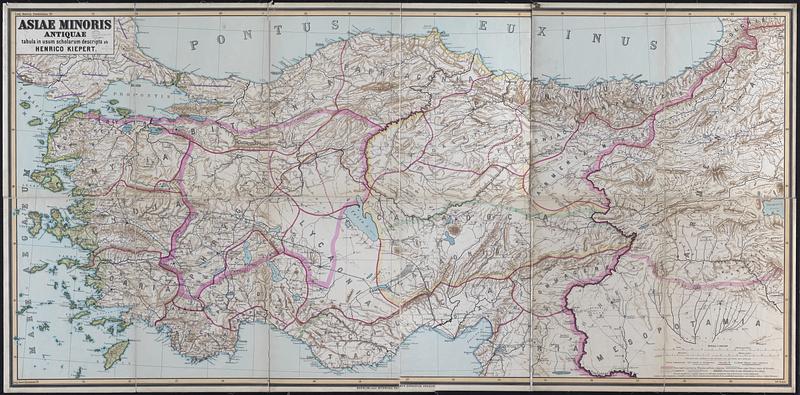
Asiae Minoris antiquae : tabula in usum scholarum descripta
Item Information
- Title:
- Asiae Minoris antiquae : tabula in usum scholarum descripta
- Cartographer:
- Kiepert, Heinrich, 1818-1899
- Publisher:
- Dietrich Reimer Verlag (Berlin, Germany)
- Name on Item:
-
ab Henrico Kiepert
- Date:
-
[1905?]
- Format:
-
Maps/Atlases
- Location:
-
Boston Public Library
Norman B. Leventhal Map & Education Center - Collection (local):
-
Norman B. Leventhal Map & Education Center Collection
- Subjects:
-
Turkey--Historical geography--Maps
- Places:
-
Turkey
- Extent:
- 1 map : color ; 92 x 192 cm
- Terms of Use:
-
No known copyright restrictions.
No known restrictions on use.
- Publisher:
-
Berolini :
editit Ditericus Reimer [Ernestus Vohsen]
- Scale:
-
Scale 1:800,000
- Language:
-
Latin
- Notes:
-
Relief shown by shading and spot heights.
Prime meridians: Greenwich and Paris.
Shows major territorial divisions, areas of Greek settlement and colonization, the route of Cyrus according to Xenophon, and the route of Alexander the Great during the ancient period in Asia Minor.
- Identifier:
-
06_01_015224
- Call #:
-
G7431.S2 1905 .K54
- Barcode:
-
39999085933164


