North Atlantic--Azores, San Miguel : from a British survey in 1844
Item Information
- Title:
- North Atlantic--Azores, San Miguel : from a British survey in 1844
- Issuing body:
- United States. Hydrographic Office
- Date:
-
1888
- Format:
-
Maps/Atlases
- Genre:
-
Nautical charts
- Location:
-
Boston Public Library
Norman B. Leventhal Map & Education Center - Collection (local):
-
Norman B. Leventhal Map & Education Center Collection
- Subjects:
-
São Miguel Island (Azores)--Maps
Nautical charts--Azores--São Miguel Island
- Places:
-
PortugalAzores (region)São Miguel, Ilha de (island)
- Extent:
- 1 map ; 42 x 55 cm
- Terms of Use:
-
No known copyright restrictions.
No known restrictions on use.
- Publisher:
-
Washington, D.C. :
Hydrographic Office
- Edition:
- Edition of May 1888
- Scale:
-
Scale approximately 1:160,000
- Language:
-
English
- Table of Contents:
-
Horta and Pim Bays, Fayal Id. Azores
Fayal Channel, Azores
- Notes:
-
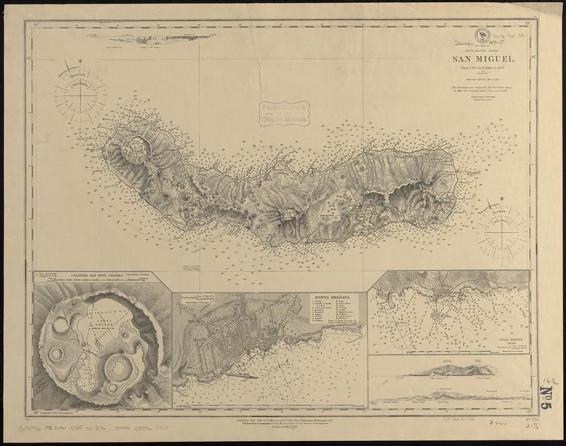
Relief shown by hachures and spot heights. Depths shown by soundings and isolines.
Includes 3 coastal views and 3 insets.
Insets: Caldeira das Sete Cidades -- Ponta Delgada -- Villa Franca Road.
- Identifier:
-
06_01_017608
- Call #:
-
G9096.P5 svar .U55 no. 276
- Barcode:
-
39999085961710


