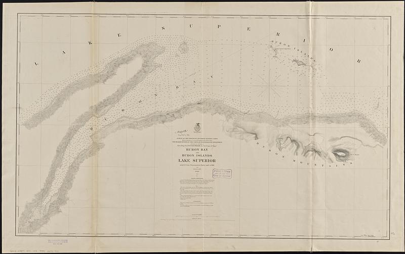
Huron Bay and Huron Islands, Lake Superior
Item Information
- Title:
- Huron Bay and Huron Islands, Lake Superior
- Issuing body:
- U.S. Lake Survey
- Contributor:
- Raynolds, W. F. (William Franklin), 1820-1894
- Surveyor:
- Mayer, J. R.
- Surveyor:
- Mayer, J. Paul
- Draftsman:
- Molitor, Albert
- Surveyor:
- Towar, F. M.
- Draftsman:
- Chaffee, O. N.
- Name on Item:
-
projected from a trigonometrical survey in 1866 and published in 1869 ; Huron Bay and Huron Islands surveyed by J.R. Mayer assisted by J.P. Mayer in 1866 ; two miles of the most eastern part by A. Molitor, assisted by F.M. Towar in 1866 ; drawn by O.N. Chaffee
- Date:
-
[1891]
- Format:
-
Maps/Atlases
- Genre:
-
Nautical charts
- Location:
-
Boston Public Library
Norman B. Leventhal Map & Education Center - Collection (local):
-
Norman B. Leventhal Map & Education Center Collection
- Subjects:
-
Huron Bay (Mich.)--Maps
Huron Islands (Mich.)--Maps
Nautical charts--Michigan--Huron Bay
Nautical charts--Michigan--Huron Islands
- Places:
-
MichiganBaraga (county)Huron Bay
MichiganMarquette (county)Huron Islands (area)
- Extent:
- 1 map ; 64 x 109 cm
- Terms of Use:
-
No known copyright restrictions.
No known restrictions on use.
- Publisher:
-
[Washington, D.C.] :
[U.S. Lake Survey]
- Scale:
-
Scale 1:30,000
- Language:
-
English
- Notes:
-
Relief shown by hachures and spot heights. Depths shown by soundings and isolines.
Includes sailing directions, note and authorities.
"Made in obedience to acts of Congress and orders from the Headquarters of the Corps of Engineers, War Department and under the direction of Brvt. Brig. Genl. W.F. Raynolds, Lt. Col. Corps of Engrs."
Stamped in purple at bottom: Aids to navigation corrected from information received to Mar 14 1891.
- Notes (date):
-
This date is inferred.
- Identifier:
-
06_01_015596
- Call #:
-
G4112.H78P5 1891 .U83
- Barcode:
-
39999085938031


