Southwest corridor restudy


Item Information
- Title:
- Southwest corridor restudy
- Description:
-
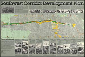
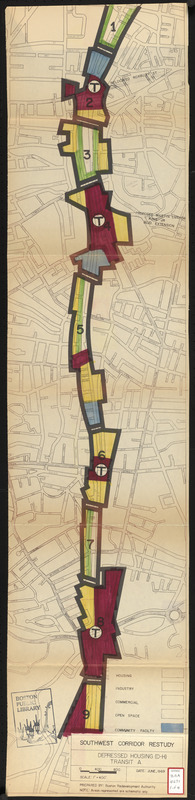
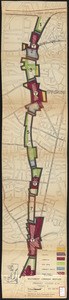
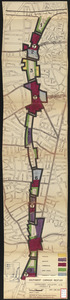
Schematic maps depicting color coded land uses (housing, industry, commercial, open space, community facilities, and "under rights development") for alternative transit proposals for the Southwest Corridor.
- Cartographer:
- Boston Redevelopment Authority
- Date:
-
June 1969
- Format:
-
Maps/Atlases
- Location:
-
Boston Public Library
Central Library in Copley Square - Collection (local):
-
Boston Public Library Collection
- Subjects:
-
Land use--Massachusetts--Boston--Maps
Southwest Corridor (Boston, Mass.)--Maps
City planning--Massachusetts--Boston--Maps
Express highways--Massachusetts--Boston--Maps
- Places:
-
Suffolk (county)Boston
- Extent:
- 4 maps : hand colored ; 113 x 26 cm
- Terms of Use:
-
No known copyright restrictions.
No known restrictions on use.
- Publisher:
-
[Boston] :
Boston Revelopment Authority
- Scale:
-
Scale 1:4,800
- Language:
-
English
- Table of Contents:
-
Depressed housing (D-H) transit A
Embanked housing (E-H) transit A
Depressed industry (D-I) transit B
Embanked industry (E-I) transit B
- Catalog Record:
-
http://bpl.bibliocommons.com/item/show/1029277075
- Notes:
-
Oriented with north to the upper left.
- Identifier:
-
06_01_017180D
06_01_017180C
06_01_017180B
06_01_017180A
- Call #:
-
BRA/4671
- Barcode:
-
mq6325928