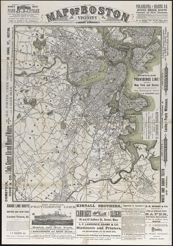
Map of Boston and vicinity : from the latest survey

Item Information
- Title:
- Map of Boston and vicinity : from the latest survey
- Title (alt.):
-
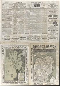
Guide to Boston
Birds-eye view of Boston Harbor
- Publisher:
- Photo-Electrotype Co. (Boston, Mass.)
- Name on Item:
-
Photo-Electrotype Co.
- Date:
-
[ca. 1880]
- Format:
-
Maps/Atlases
- Location:
-
Boston Public Library
Norman B. Leventhal Map & Education Center - Collection (local):
-
Norman B. Leventhal Map & Education Center Collection
- Subjects:
-
Boston (Mass.)--Maps
- Places:
-
MassachusettsSuffolk (county)Boston
- Extent:
- 1 map : color ; 59 x 50 cm, on sheet 83 x 58 cm, folded to 41 x 29 cm
- Terms of Use:
-
No known copyright restrictions.
No known restrictions on use.
- Publisher:
-
Boston :
Published by the Photo-Electrotype Co., 171 Devonshire Street
- Scale:
-
Scale approximately 1:27,500
- Language:
-
English
- Notes:
-
Concentric circles show half-mile distances from City Hall.
Includes advertisements and illustrations.
On verso: text, advertisements, illustrations, view of Boston Harbor, map of Boston proper, and "Birds-eye view of Boston Harbor".
- Identifier:
-
06_01_017366A
06_01_017366B
- Call #:
-
G3764.B6 1880 .E44
- Barcode:
-
39999085956181


