Plan of the city of Boston : plate 17
Item Information
- Title:
- Plan of the city of Boston : plate 17
- Description:
-
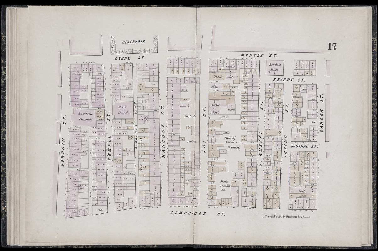
During the antebellum period, Boston had a thriving free African American community. By 1860, more than half the city’s black population of 2,000 lived on the north slope of Beacon Hill adjacent to the Massachusetts State House. This neighborhood became a center for Boston’s abolitionist movement and many fugitive slaves escaping via the Underground Railroad found refuge here. A portion of this neighborhood is depicted on a sheet from an 1861 fire-insurance atlas. Of particular interest are the church and school on the alley (today’s Smith Court) off Joy Street, marking the location of the African Meeting House, the oldest extant black church building in the United States, and the Abiel Smith School, the only black public school in Boston until 1855, when schools were integrated.
- Cartographer:
- Pinney, C.
- Publisher:
- L. Prang & Co.
- Date:
-
1861
- Format:
-
Maps/Atlases
- Location:
-
Boston Public Library
Norman B. Leventhal Map & Education Center - Collection (local):
-
Norman B. Leventhal Map & Education Center Collection
- Subjects:
-
Real property--Massachusetts--Boston--Maps
Boston (Mass.)--Maps
- Places:
-
MassachusettsSuffolk (county)Boston
- Extent:
- 1 map : color ; sheet 51 x 72 cm
- Terms of Use:
-
No known copyright restrictions.
No known restrictions on use.
- Publisher:
-
Boston :
L. Prang & Co.
- Scale:
-
Scale not given
- Language:
-
English
- Notes:
-
Digitization made possible with support from the Council on Library and Information Resources.
- Notes (exhibitions):
-
Exhibited: "Torn in Two: The 150th Anniversary of the Civil War" organized by the Norman B. Leventhal Map Center at the Boston Public Library, 2011.
- Identifier:
-
G1234_B6G475_P5_1861x_0019
- Call #:
-
G1234.B6G475 P5 1861x
- Barcode:
-
39999059012045


