Geological map Allegheny River Valley accompanying report of Allegheny River survey Nov. 25, 1898
Item Information
- Title:
- Geological map Allegheny River Valley accompanying report of Allegheny River survey Nov. 25, 1898
- Cartographer:
- Powell, Charles F.
- Contributor:
- United States. Army. Corps of Engineers
- Contributor:
- United States. Congress. House. Report
- Name on Item:
-
Chas. F. Powell, Major, Corps of Engineers, U.S.A.
- Date:
-
[1899]
- Format:
-
Maps/Atlases
- Genre:
-
Geological maps
Geological cross-sections
- Location:
-
Boston Public Library
Norman B. Leventhal Map & Education Center - Collection (local):
-
Norman B. Leventhal Map & Education Center Collection
- Subjects:
-
Allegheny River Valley (Pa. and N.Y.)--Maps
Geology--Allegheny River Valley (Pa. and N.Y.)--Maps
- Places:
-
Allegheny River
Pennsylvania
- Extent:
- 1 map : color ; 33 x 19 cm on sheet 40 x 47 cm
- Terms of Use:
-
No known copyright restrictions.
No known restrictions on use.
- Publisher:
-
[Washington] :
[Government Printing Office]
- Scale:
-
Scale approximately 1:380,000
- Language:
-
English
- Notes:
-
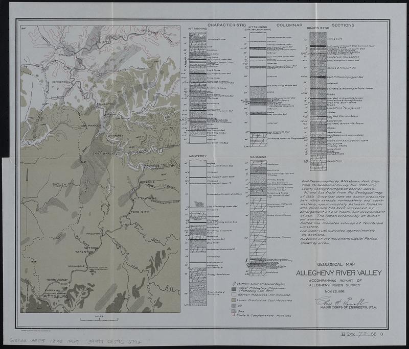
Relief shown by form lines and spot heights.
Includes illustrations of characteristic columnar sections for Kittanning, Kittanning (2 ms. abv. right bank), Brady's Bend, Monterey, and Mahoning.
In lower right: H Doc 72 55 3.
From Congressional serial set, 55th Congress, 3d session, House reports (Washington : Government Printing Office, 1899).
- Notes (date):
-
This date is inferred.
- Identifier:
-
06_01_018365
- Call #:
-
G3822.A5C5 1898 .P69
- Barcode:
-
39999085966792


