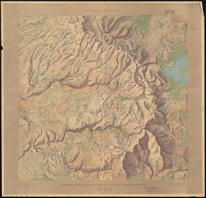
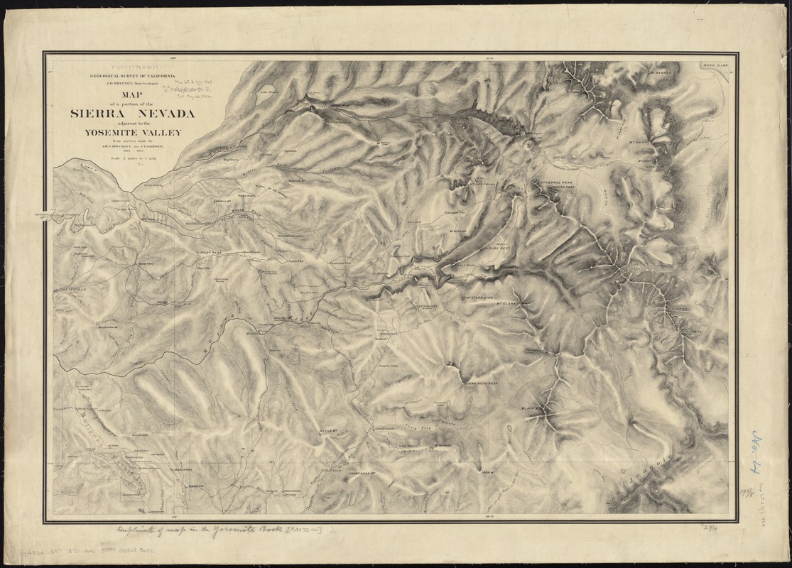
Map of a portion of the Sierra Nevada adjacent to the Yosemite Valley
Item Information
- Title:
- Map of a portion of the Sierra Nevada adjacent to the Yosemite Valley
- Creator:
- Geological Survey of California
- Name on Item:
-
from surveys made by Chs. F. Hoffmann and J.T. Gardner, 1863-1867.
- Date:
-
[1870]
- Format:
-
Maps/Atlases
- Location:
-
Boston Public Library
Norman B. Leventhal Map & Education Center - Collection (local):
-
Norman B. Leventhal Map & Education Center Collection
- Subjects:
-
Yosemite National Park (Calif.)--Maps
Sierra Nevada (Calif. and Nev.)--Maps
1863–1867
- Places:
-
CaliforniaMariposa (county)Yosemite National Park
Nevada, Sierra (area)
- Extent:
- 1 map ; 50 x 77 cm.
- Terms of Use:
-
No known copyright restrictions.
No known restrictions on use.
- Publisher:
-
[Sacramento, Calif.] :
The Survey
- Edition:
- [3rd issue].
- Scale:
-
Scale [1:126,720]. 2 miles to 1 in.
- Language:
-
English
- Notes:
-
Relief shown by hachures.
Extends from Mariposa to Big Oak Flat and east to Mono Lake.
In 3rd issue, Hite's Cove located south of the Merced on "Road to Hite's Cove;" erasure of the prior label at the junction of the Merced and Devil's Gulch is apparent. Other place names added or removed.
- Notes (date):
-
This date is inferred.
- Identifier:
-
06_01_011449
- Barcode:
-
39999065685602