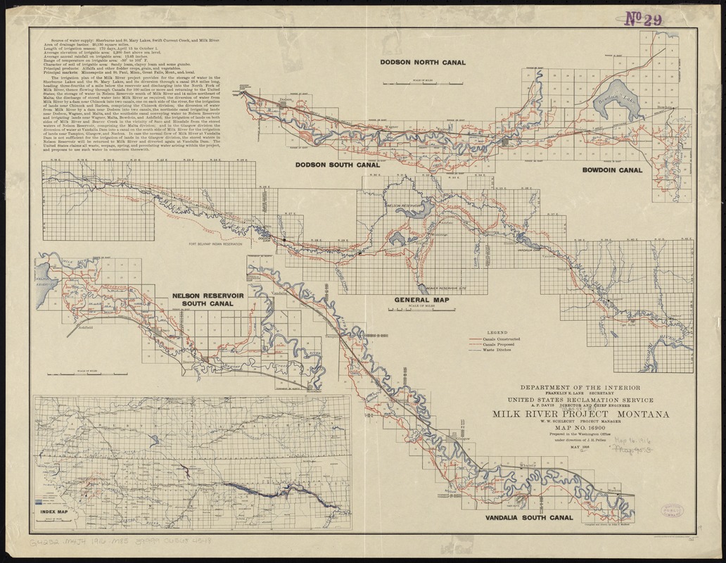
Milk River Irrigation Project, Montana
Item Information
- Title:
- Milk River Irrigation Project, Montana
- Creator:
- Mulford, John C.
- Name on Item:
-
Department of the Interior, United States Reclamation Service ; prepared in the Washington Office ; compiled and drawn by John C. Mulford.
- Date:
-
1916
- Format:
-
Maps/Atlases
- Location:
-
Boston Public Library
Norman B. Leventhal Map & Education Center - Collection (local):
-
Norman B. Leventhal Map & Education Center Collection
- Subjects:
-
Milk River Project (U.S.)--Maps
Irrigation--Milk River (Mont. and Alta.)--Maps
Milk River (Mont. and Alta.)--Maps
- Places:
-
Milk River (river)
- Extent:
- 4 maps on 1 sheet : col. ; 54 x 68 cm.
- Terms of Use:
-
No known copyright restrictions.
No known restrictions on use.
- Publisher:
-
Washington, D.C :
[U.S. Reclamation Service]
- Scale:
-
Scales differ.
- Language:
-
English
- Table of Contents:
-
Dodson South Canal ; Dodson North Canal ; Bowdoin Canal
General map
Nelson Reservoir South Canal
Vandalia South Canal.
- Notes:
-
Includes text and index map.
Department of the Interior, Franklin K. Lane Secretary, United States Reclamation Service, A.P. Davis, Director and Chief Engineer, Milk River Project Montana, W.W. Schlecht, Project Manager.
Engraved and printed by the U.S. Geological Survey
Prepared in the Washington Office under direction of J.H. Pellen, May 1916.
"Map no. 16900" --Recto.
- Identifier:
-
06_01_011364
- Call #:
-
G4252.M4J4 1916 .M85
- Barcode:
-
39999065684548


