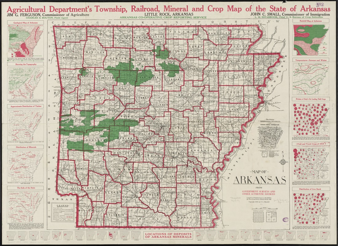
Map of Arkansas : from government and other authentic sources
Item Information
- Title:
- Map of Arkansas : from government and other authentic sources
- Title above map :
- Agricultural deparment's township, railroad, mineral and crop map of the state of Arkansas
- Creator:
- Blaisdell, F. L.
- Name on Item:
-
compiled and published by F.L. Blaisdell.
- Date:
-
1919
- Format:
-
Maps/Atlases
- Location:
-
Boston Public Library
Norman B. Leventhal Map & Education Center - Collection (local):
-
Norman B. Leventhal Map & Education Center Collection
- Subjects:
-
Agriculture--Arkansas--Maps
Geology--Arkansas--Maps
Forests and forestry--Arkansas--Maps
Livestock--Arkansas--Maps
Mines and mineral resources--Arkansas--Maps
Soils--Arkansas--Maps
Arkansas--Climate--Maps
- Places:
-
Arkansas
- Extent:
- 1 map : col ; 72 x 82 cm.
- Terms of Use:
-
No known copyright restrictions.
No known restrictions on use.
- Publisher:
-
Little Rock, Ark :
State Bureau of Mines, Manufactures and Agriculture
- Scale:
-
Scale [ca. 1:570,000]
- Language:
-
English
- Notes:
-
Inset: Map showing congressional districts and normal annual temperatures.
Ancillary maps: Geological map of Arkansas -- Showing the topography -- Approximate distribution of timber -- Distribution of minerals -- The soils of the state -- Rainfall map of Arkansas -- Temperatures - summer and winter -- Division of state's six leading field crops -- Fruit and truck crops of 1919 -- Distribution of live stock.
Includes 24 maps indicating "locations of deposits of Arkansas minerals."
Text and ill. on verso, titled Arkansas' seventy-five counties briefly described.
- Identifier:
-
06_01_011035
- Call #:
-
G4000 1919 .B53
- Barcode:
-
39999065680298


