A hexagonal chart of yearly snowfall in New England up through and including November 1, 2020
Item Information
- Title:
- A hexagonal chart of yearly snowfall in New England up through and including November 1, 2020
- Description:
-
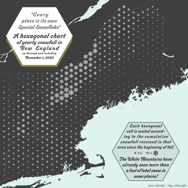
Geographers sometimes use a hexagonal grid, or "hexbin," to show the distribution of a phenomenon across space. In this map, the size of the snowflake in each hexagon represents the total amount of snowfall measured in that area since September 30, 2020, the beginning of the climatological snow season. It's been a pretty snowy year so far, with more than a foot of snow falling in total in parts of the White Mountains. But Massachusetts has also seen a fair amount of snow, with many places covered in a few inches on Halloween.
- Cartographer:
- Boston Public Library. Norman B. Leventhal Map and Education Center
- Name on Item:
-
LMEC@BPL
- Date:
-
[2020]
- Format:
-
Maps/Atlases
- Location:
-
Boston Public Library
Norman B. Leventhal Map & Education Center - Collection (local):
-
Norman B. Leventhal Map & Education Center Collection
- Subjects:
-
Snow--New England--Maps
- Places:
-
New England (area)
- Extent:
- 1 map : color
- Terms of Use:
-
No known copyright restrictions.
No known restrictions on use.
- Language:
-
English
- Notes:
-
"Data: NOHRSC."
- Notes (date):
-
This date is inferred.
- Identifier:
-
hexagonal-snow


