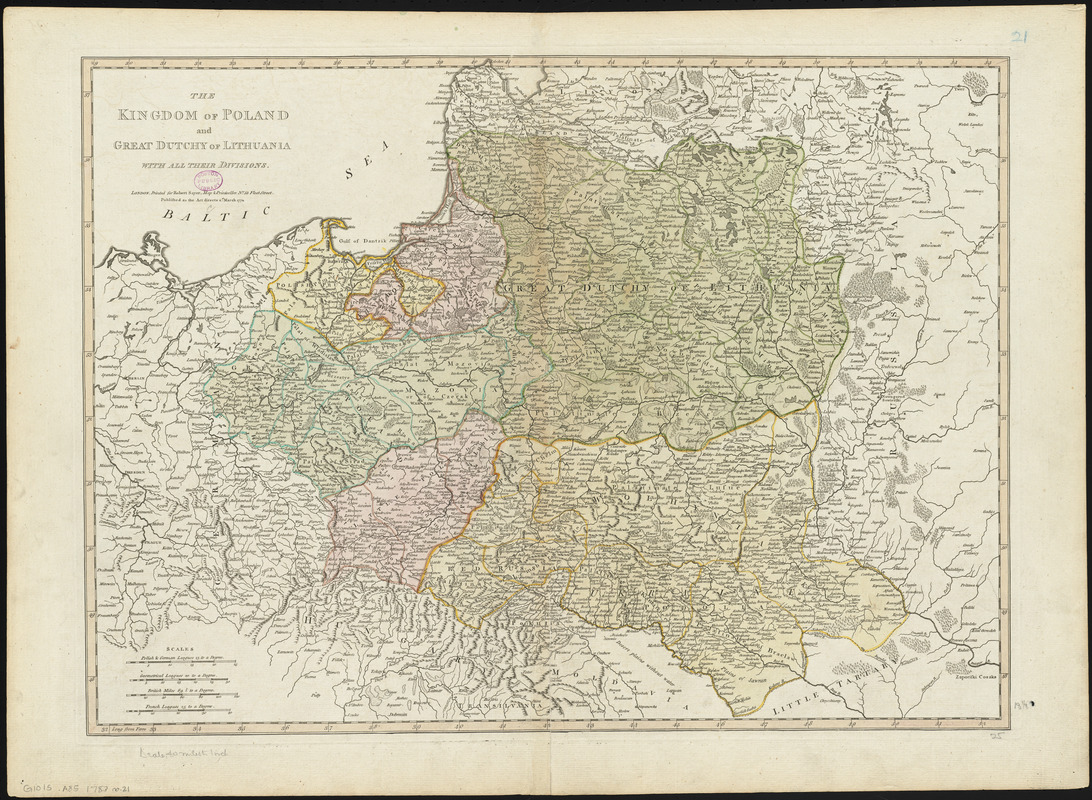
The kingdom of Poland and Great Dutchy of Lithuania with all their divisions
Item Information
- Title:
- The kingdom of Poland and Great Dutchy of Lithuania with all their divisions
- Publisher:
- Sayer, Robert, 1725-1794
- Date:
-
1772
- Format:
-
Maps/Atlases
- Location:
-
Boston Public Library
Norman B. Leventhal Map & Education Center - Collection (local):
-
Norman B. Leventhal Map & Education Center Collection
- Subjects:
-
Poland--Early works to 1800--Maps
Lithuania (Grand Duchy)--Early works to 1800--Maps
- Places:
-
Lithuania
Poland
- Extent:
- 1 map : hand colored ; 48 x 64 cm
- Terms of Use:
-
No known copyright restrictions.
No known restrictions on use.
- Publisher:
-
London :
Printed for Robert Sayer
- Scale:
-
Scale approximately 1:2,500,000
- Language:
-
English
- Notes:
-
Shows boundaries, rivers, roads, forests and settlements.
Relief shown pictorially.
Prime meridian: Ferro.
Poland and Lithuania.
Conservation of this piece was funded by Alan and Sherry Leventhal in memory of his father, Norman B. Leventhal whose vision to create this Map Center will inspire generations to come.
Map 21 in a composite atlas with the title "Atlas of the world."
- Identifier:
-
06_01_014677
- Call #:
-
G1015 .A85 1783
- Barcode:
-
30000004730317


