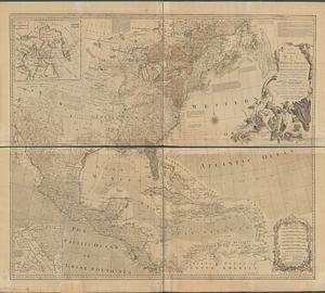
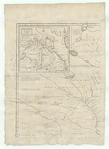
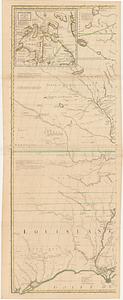
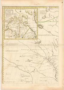
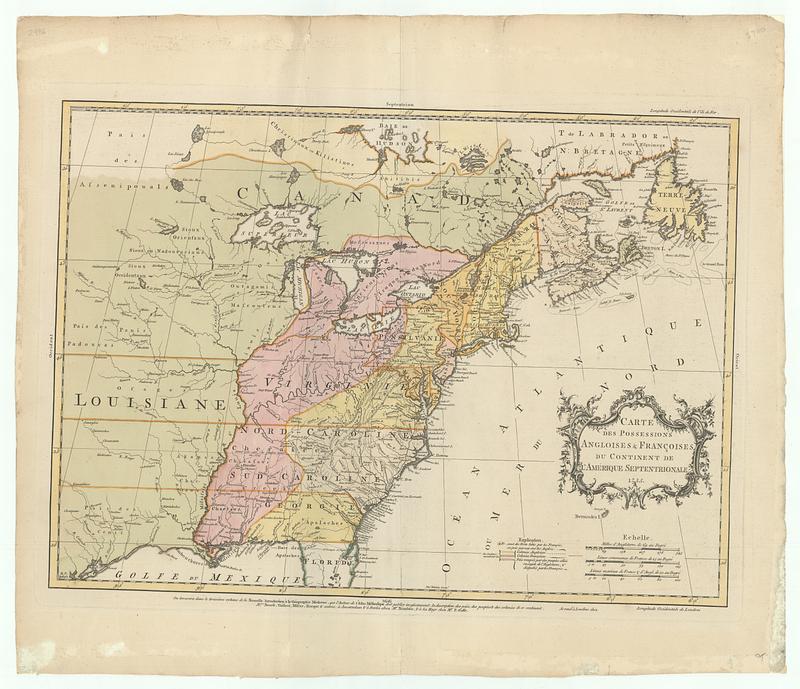
Carte des possessions angloises & françoises du continent de l'Amérique Septentrionale
This map is also available in American Revolutionary Geographies Online (ARGO), a collections portal especially built for material relating to the American Revolutionary War Era. Visit ARGO to learn more about this item and explore the historical geography of North America in the late eighteenth century.
Item Information
- Title:
- Carte des possessions angloises & françoises du continent de l'Amérique Septentrionale
- Contributor:
- Palairet, Jean, 1697-1774
- Publisher:
- Nourse, J. (John), -1780
- Publisher:
- Vaillant, Paul, -1802
- Publisher:
- Millar, Andrew, 1705-1768
- Publisher:
- Rocque, John, -1762
- Name on Item:
-
Tho.s Kitchin sculp.t
- Date:
-
1755
- Format:
-
Maps/Atlases
- Location:
- MacLean Collection Map Library
- Collection (local):
-
MacLean Collection Map Library
- Subjects:
-
North America--Maps--Early works to 1800
- Places:
-
North America (area)
- Extent:
- 1 map ; 413 x 574 mm
- Terms of Use:
-
Public Domain/No known restrictions on use. Contact host institution to download image.
Contact host institution for more information.
- Publisher:
-
London ; Amsterdam ; Berlin ; La Haye :
Chez M.rs Nourse, Vaillant, Millar, Rocque & autres ; Chez M.r Neaulme ; chez M.r P. Gosse
- Edition:
- First state
- Language:
-
French
- Notes:
-
"On trouvera dans le troisiéme volume de la Nouvelle introduction à la géographie moderne, que l'auteur de l'Atlas méthodique doit publier incessament, la description des païs, des peuples & des colonies de ce continent."
- Identifier:
-
MC_31479
- Call #:
-
31479