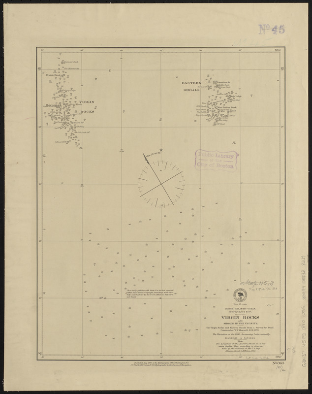
North Atlantic Ocean, Newfoundland Bank, Virgin Rocks and shoals in the vicinity
Item Information
- Title:
- North Atlantic Ocean, Newfoundland Bank, Virgin Rocks and shoals in the vicinity
- Title (alt.):
-
Virgin Rocks and shoals in the vicinity
- Issuing body:
- United States. Hydrographic Office
- Date:
-
1880
- Format:
-
Maps/Atlases
- Location:
-
Boston Public Library
Norman B. Leventhal Map & Education Center - Collection (local):
-
Norman B. Leventhal Map & Education Center Collection
- Subjects:
-
Nautical charts--Newfoundland and Labrador--Virgin Rocks
Virgin Rocks (N.L.)--Maps
- Places:
-
CanadaNewfoundland and Labrador (province)
Virgin Rocks
- Extent:
- 1 map ; 41 x 32 cm
- Terms of Use:
-
No known copyright restrictions.
No known restrictions on use.
- Publisher:
-
Washington, D.C. :
Hydrographic Office
- Scale:
-
Scale approximately 1:121,000
- Language:
-
English
- Notes:
-
Depths shown by soundings and form lines.
- Identifier:
-
06_01_015551
- Call #:
-
G9096.P5 svar .U55
- Barcode:
-
39999085938239


