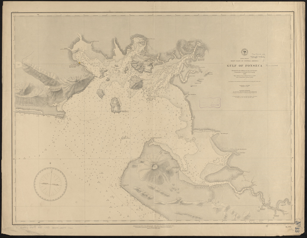
North America, west coast of Central America, Gulf of Fonseca
Item Information
- Title:
- North America, west coast of Central America, Gulf of Fonseca
- Title (alt.):
-
Gulf of Fonseca
- Issuing body:
- United States. Hydrographic Office
- Engraver:
- Franke, M. (Max)
- Engraver:
- Kübel, S. J. (Stephen J.)
- Engraver:
- Waddey, J. A. (John A.)
- Name on Item:
-
surveyed by the officers of the U.S.S. Ranger, Commander C.E. Clark, U.S.N. comd'g 1884, with additions from a British survey in 1838 and a United States survey in 1857 ; drawn by M. Franke ; engraved by S.J. Kübel and J.A. Waddey
- Date:
-
1888
- Format:
-
Maps/Atlases
- Location:
-
Boston Public Library
Norman B. Leventhal Map & Education Center - Collection (local):
-
Norman B. Leventhal Map & Education Center Collection
- Subjects:
-
Nautical charts--Fonseca, Gulf of
Fonseca, Gulf of--Maps
- Places:
-
Fonseca, Golfo de (gulf)
- Extent:
- 1 map ; 54 x 74 cm
- Terms of Use:
-
No known copyright restrictions.
No known restrictions on use.
- Publisher:
-
Washington, D.C. :
Hydrographic Office
- Edition:
- Edition of December 1888
- Scale:
-
Scale approximately 1:147,000
- Language:
-
English
- Notes:
-
Relief shown by contours, shading and spot heights. Depths shown by soundings and isolines.
- Identifier:
-
06_01_015847
- Call #:
-
G9096.P5 svar .U55
- Barcode:
-
39999085940466


