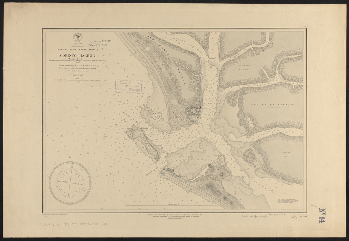
North America, west coast of Central America, Corinto Harbor
Item Information
- Title:
- North America, west coast of Central America, Corinto Harbor
- Title (alt.):
-
Corinto Harbor
- Issuing body:
- United States. Hydrographic Office
- Name on Item:
-
surveyed by the officers of the U.S.S. Ranger, Commander C.E. Clark U.S.N. comdg., 1884 ; engraved by W.M. Dougal
- Date:
-
1889
- Format:
-
Maps/Atlases
- Location:
-
Boston Public Library
Norman B. Leventhal Map & Education Center - Collection (local):
-
Norman B. Leventhal Map & Education Center Collection
- Subjects:
-
Harbors--Nicaragua--Corinto--Maps
Nautical charts--Nicaragua--Corinto
Corinto (Nicaragua)--Maps
- Places:
-
NicaraguaChinandegaCorinto
- Extent:
- 1 map ; 37 x 54 cm
- Terms of Use:
-
No known copyright restrictions.
No known restrictions on use.
- Publisher:
-
Washington, D.C. :
Hydrographic Office
- Edition:
- Edition of April 1889
- Scale:
-
Scale approximately 1:18,500
- Language:
-
English
- Notes:
-
Relief shown by hachures and spot heights. Depths shown by soundings.
- Identifier:
-
06_01_015879
- Call #:
-
G9096.P5 svar .U55
- Barcode:
-
39999085941274


