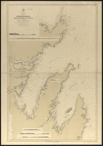
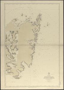
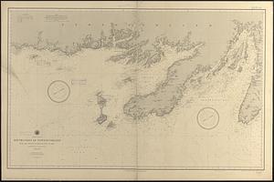
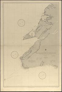
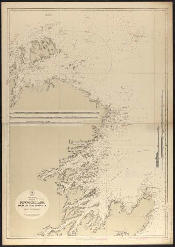
North America, east coast of Newfoundland, Fogo Id. to Cape Bonavista : from Brit. surveys 1869-1871 ; republication of Brit. Admty. chart no. 293
Item Information
- Title:
- North America, east coast of Newfoundland, Fogo Id. to Cape Bonavista : from Brit. surveys 1869-1871 ; republication of Brit. Admty. chart no. 293
- Title (alt.):
-
Fogo Id. to Cape Bonavista
- Issuing body:
- United States. Hydrographic Office
- Date:
-
1886
- Format:
-
Maps/Atlases
- Location:
-
Boston Public Library
Norman B. Leventhal Map & Education Center - Collection (local):
-
Norman B. Leventhal Map & Education Center Collection
- Subjects:
-
Coasts--Newfoundland and Labrador--Maps
Nautical charts--Newfoundland and Labrador
Nautical charts--Newfoundland and Labrador--Bonavista Bay
Nautical charts--Newfoundland and Labrador--Hamilton Sound
Newfoundland and Labrador--Maps
Bonavista Bay (N.L.)--Maps
Hamilton Sound (N.L.)--Maps
- Places:
-
CanadaNewfoundland and Labrador (province)Bonavista Bay
CanadaNewfoundland and Labrador (province)Hamilton Sound
- Extent:
- 1 map : color ; 100 x 73 cm
- Terms of Use:
-
No known copyright restrictions.
No known restrictions on use.
- Publisher:
-
Washington, D.C. :
Hydrographic Office
- Scale:
-
Scale approximately 1:176,000
- Language:
-
English
- Notes:
-
Relief shown by hachures and spot heights. Depths shown by soundings and isolines.
Boston Public Library copy includes manuscript additions in red ink.
Includes 5 coastal views.
"Cor. (54.VIII.79)(29.V.81)."
"Cor. (VIII.77.)(V.78.)(I.82)(IX.86)."
"Cor. (XII.74)(18-I.80.)(30-II.83)."
- Identifier:
-
06_01_016382
- Call #:
-
G9096.P5 svar .U55
- Barcode:
-
39999085946331