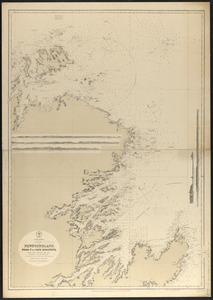
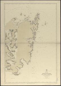
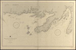
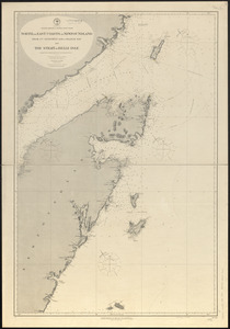
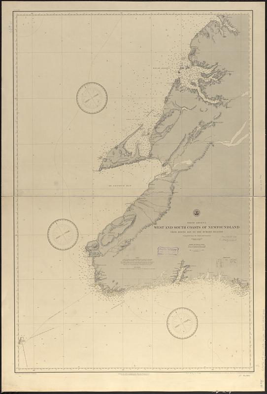
North America, west and south coasts of Newfoundland, from Bonne Bay to the Burgeo Islands : compiled from the latest information
Item Information
- Title:
- North America, west and south coasts of Newfoundland, from Bonne Bay to the Burgeo Islands : compiled from the latest information
- Issuing body:
- United States. Hydrographic Office
- Engraver:
- Franke, M. (Max)
- Draftsman:
- Klakring, A. (Alfred)
- Engraver:
- Kübel, S. J. (Stephen J.)
- Engraver:
- Ruebsam, A. C. (Adolph C.)
- Draftsman:
- Wimpffen, L. F. von (Lebreclit Felix von)
- Name on Item:
-
drawn by L. von Wimpffen and A. Klakring ; engraved by S.J. Kübel, M. Franke and A.C. Ruebsam
- Date:
-
1888
- Format:
-
Maps/Atlases
- Genre:
-
Nautical charts
- Location:
-
Boston Public Library
Norman B. Leventhal Map & Education Center - Collection (local):
-
Norman B. Leventhal Map & Education Center Collection
- Subjects:
-
Newfoundland and Labrador--Maps
Coasts--Newfoundland and Labrador--Maps
Nautical charts--Newfoundland and Labrador
- Places:
-
CanadaNewfoundland and Labrador (province)
- Extent:
- 1 map ; 98 x 64 cm
- Terms of Use:
-
No known copyright restrictions.
No known restrictions on use.
- Publisher:
-
[Washington, D.C.] :
Hydrographic Office
- Scale:
-
Scale approximately 1:300,000
- Language:
-
English
- Notes:
-
Relief shown by hachures and spot heights. Depths shown by soundings and isolines.
- Identifier:
-
06_01_017035
- Call #:
-
G9096.P5 svar .U55 no. 1104
- Barcode:
-
39999085953923