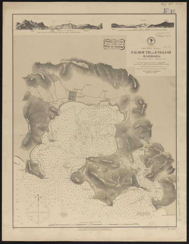
West Indies, Antigua, Falmouth and English Harbors : from British surveys corrected to 1872
Item Information
- Title:
- West Indies, Antigua, Falmouth and English Harbors : from British surveys corrected to 1872
- Title (alt.):
-
Falmouth and English Harbors
- Issuing body:
- United States. Hydrographic Office
- Date:
-
1872
- Format:
-
Maps/Atlases
- Location:
-
Boston Public Library
Norman B. Leventhal Map & Education Center - Collection (local):
-
Norman B. Leventhal Map & Education Center Collection
- Subjects:
-
Nautical charts--Antigua and Barbuda--English Harbour
Nautical charts--Antigua and Barbuda--Falmouth Harbour
English Harbour (Antigua and Barbuda)--Maps
Falmouth Harbour (Antigua and Barbuda)--Maps
- Places:
-
Antigua and BarbudaSaint John (county)Saint Johns
Antigua and BarbudaSaint Paul (county)Falmouth
- Extent:
- 1 map : color ; 59 x 45 cm.
- Terms of Use:
-
No known copyright restrictions.
No known restrictions on use.
- Publisher:
-
Washington, D.C. :
Hydrographic Office
- Scale:
-
Scale approximately 1:8,300
- Language:
-
English
- Notes:
-
Relief shown by hachures and spot heights. Depths shown by soundings and isolines.
Includes notes and 2 coastal views.
- Identifier:
-
06_01_015641
- Call #:
-
G9096.P5 svar .U55
- Barcode:
-
39999085938536


