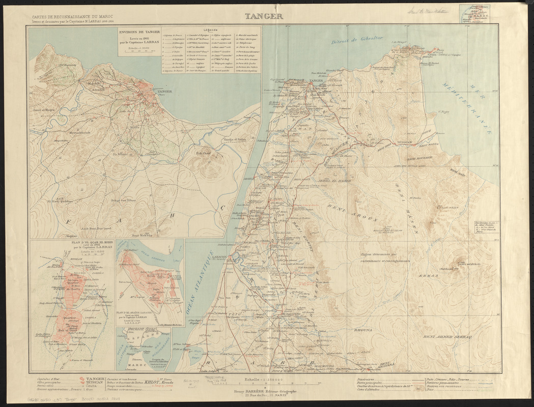
Tanger
Item Information
- Title:
- Tanger
- Title (alt.):
-
Cartes de reconnaissance du Maroc
- Cartographer:
- Larras, N.
- Publisher:
- Barrère, Henry
- Name on Item:
-
levées et dessinées par le Capitaine N. Larras 1898-1906
- Date:
-
[1906]
- Format:
-
Maps/Atlases
- Location:
-
Boston Public Library
Norman B. Leventhal Map & Education Center - Collection (local):
-
Norman B. Leventhal Map & Education Center Collection
- Subjects:
-
Tangier (Morocco)--Maps
- Places:
-
MoroccoTanger-Tétouan-Al Hoceïma (region)Tangier
- Extent:
- 1 map : color ; 52 x 71 cm
- Terms of Use:
-
No known copyright restrictions.
No known restrictions on use.
- Publisher:
-
Paris :
Henry Barrère
- Scale:
-
Scale 1:250,000
- Language:
-
French
- Notes:
-
Relief shown by form lines and spot heights.
Prime meridian: [Paris].
Diagram of sheets in upper right.
Insets: Environs de Tanger -- Plan d'el Qcar el Kebir -- Plan d'el Araïch (Larache) -- Croquis du Dêtroit de Gibraltar.
- Notes (date):
-
This date is inferred.
- Identifier:
-
06_01_015424
- Call #:
-
G8230 s250 .L37
- Barcode:
-
30000005122828


