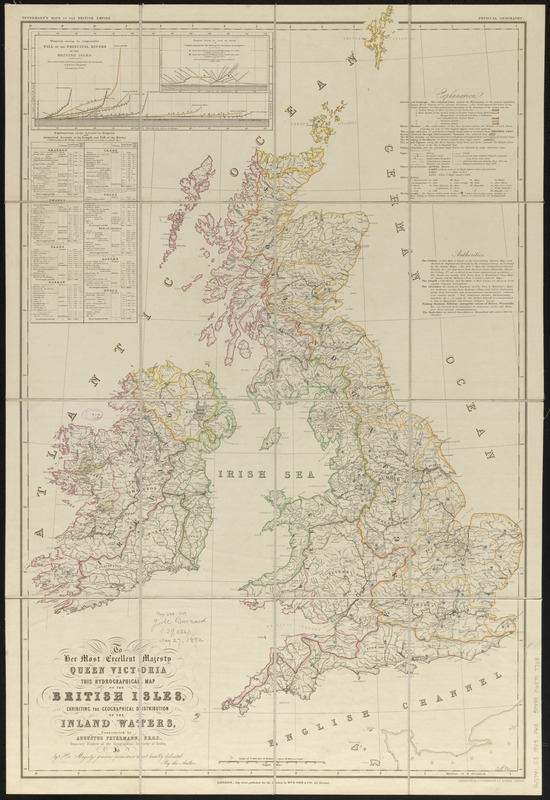
To her most excellent majesty Queen Victoria this hydrographical map of the British Isles, exhibiting the geographical distribution of the inland waters
Item Information
- Title:
- To her most excellent majesty Queen Victoria this hydrographical map of the British Isles, exhibiting the geographical distribution of the inland waters
- Title (alt.):
-
This hydrographical map of the British Isles, exhibiting the geographical distribution of the inland waters
- Cartographer:
- Petermann, A. (August), 1822-1878
- Engraver:
- Dower, John, active 1838-1846?
- Publisher:
- Wm. S. Orr and Company
- Name on Item:
-
constructed by Augustus Petermann F.R.G.S, honorary member of the Geographical Society of Berlin ; is by Her Majesty's gracious permission most humbly dedicated by the author ; engraved by A. Petermann & I. Dower
- Date:
-
1849
- Format:
-
Maps/Atlases
- Location:
-
Boston Public Library
Norman B. Leventhal Map & Education Center - Collection (local):
-
Norman B. Leventhal Map & Education Center Collection
- Subjects:
-
Hydrography--British Isles--Maps
Hydrology--British Isles--Maps
British Isles--Maps
- Places:
-
British Isles (area)
- Extent:
- 1 map : color ; 82 x 54 cm
- Terms of Use:
-
No known copyright restrictions.
No known restrictions on use.
- Publisher:
-
London :
Wm. S. Orr & Co.
- Scale:
-
Scale 1:600,000
- Language:
-
English
- Notes:
-
Includes diagram, table, explanation and authorities.
In upper margin: Petermann's maps of the British Empire -- physical geography.
- Identifier:
-
06_01_014867
- Call #:
-
G5741.C3 1849 .P48
- Barcode:
-
39999065707703


