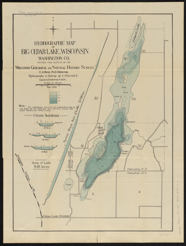
Hydrographic map of Big Cedar Lake, Wisconsin, Washington Co.
Item Information
- Title:
- Hydrographic map of Big Cedar Lake, Wisconsin, Washington Co.
- Title (alt.):
-
Hydrographic map of Big Cedar Lake, Washington County, Wis.
- Cartographer:
- Smith, Leonard S. (Leonard Sewall), 1864-1947
- Publisher:
- Wisconsin Geological and Natural History Survey
- Name on Item:
-
prepared from surveys by the Wisconsin Geological and Natural History Survey ; hydrography in charge of L.S. Smith, C.E.
- Date:
-
1901
(created)
(c) 1899 (copyright)
- Format:
-
Maps/Atlases
- Location:
-
Boston Public Library
Norman B. Leventhal Map & Education Center - Collection (local):
-
Norman B. Leventhal Map & Education Center Collection
- Subjects:
-
Hydrology--Wisconsin--Cedar Lake (Washington County)--Maps
Cedar Lake (Washington County, Wis.)--Maps
- Places:
-
WisconsinWashington (county)Cedar Lake
- Extent:
- 1 map : color ; 46 x 34 cm, folded in cover 20 x 11 cm
- Terms of Use:
-
No known copyright restrictions.
No known restrictions on use.
- Publisher:
-
Madison, Wisconsin :
Wisconsin Geological and Natural History Survey
- Scale:
-
Scale approximately 1:16,500
- Language:
-
English
- Notes:
-
Nov. 1899.
Depths shown by hypsometric tints, bathymetric isolines and soundings.
"Contour interval = 10 ft."
Includes 4 cross sections.
At head of cover title: no. 9.
Explanation of map on verso of front cover.
Imprint from cover.
- Identifier:
-
06_01_016651
- Call #:
-
G4122.C36C3 1899 .H93
- Barcode:
-
39999085950218


