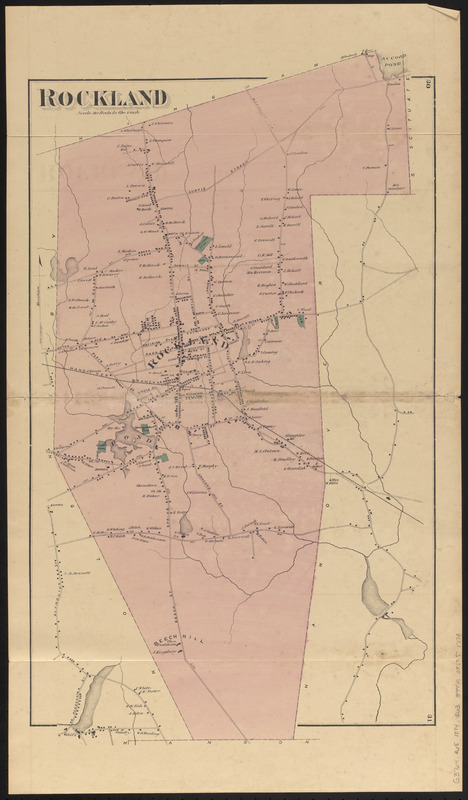
Rockland
Item Information
- Title:
- Rockland
- Date:
-
1874
- Format:
-
Maps/Atlases
- Location:
-
Boston Public Library
Norman B. Leventhal Map & Education Center - Collection (local):
-
Norman B. Leventhal Map & Education Center Collection
- Subjects:
-
Landowners--Massachusetts--Rockland--Maps
Rockland (Mass.)--Maps
- Places:
-
MassachusettsPlymouth (county)Rockland
- Extent:
- 1 map : color ; 60 x 35 cm
- Terms of Use:
-
No known copyright restrictions.
No known restrictions on use.
- Publisher:
-
[Place of publication not identified] :
[publisher not identified]
- Scale:
-
Scale 1:15,840. 80 rods to the inch
- Language:
-
English
- Notes:
-
Relief shown by hachures.
Shows residences and landownership.
Pages 30-31 from an undetermined atlas.
Does not show adjacent town of Whitman (established 1875).
- Identifier:
-
06_01_016746
- Call #:
-
G3764.R65 1874 .R63
- Barcode:
-
39999085951778