


Trying to connect math and mapmaking? There are endless connections between the two, but one may find this map set a useful place to begin. This map set and lesson will walk a viewer through some of the decisions that mapmakers make through the lens of proportional reasoning. The proportional reasoning domain begins in early elementary, is developed all throughout middle school, and is ultimately applied to the higher mathematics classics in high school and beyond. This map set is a great introduction to the idea of proportional reasoning and can get a viewer thinking about perspectives in mapmaking.
This map set begins with an introduction to scale. Maps have three different categories for scale: small scale, medium scale, and large scale. The scope of this map set is to introduce an audience to the motivation for mapmakers to choose different scales. A viewer will consider the advantages for a mapmaker choosing a scale in terms of intention and design. Mathematical extensions include reasoning out the naming of scale, for example why "small scale" is called "small", using their knowledge of fraction comparisons. While this type of scale refers to how "zoomed in" objects appear in a map, it has obvious connections to how scale is used to describe distance on a map. While the distinction between the two should be made, students can reason about the relationship between the two scales.
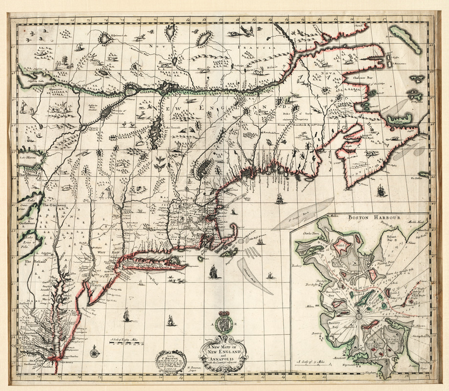
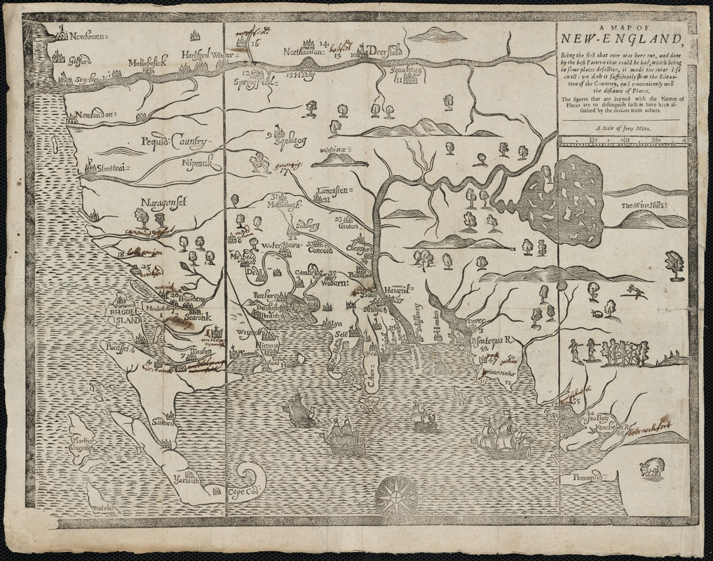
The map set then goes on to introduce the styling choice of mapmakers in an English perspective. A viewer will be challenged to identify the exaggerated components of the map as well as downplayed components in service of understanding the English perspective. Maps of John Seller and John Smith are used to accomplish this goal, with the intention that the viewer notices the emphasis on resources in the map as well as the marginalization of indigenous people. In addition, the John Smith map is clearly focused on the Atlantic Ocean which shows its connections to navigation. Mathematical extensions of this activity could include calculating how big the wildlife would be in "real life" if they were as big as depicted on the map and looking at area comparisons of different territory as the English depicted.
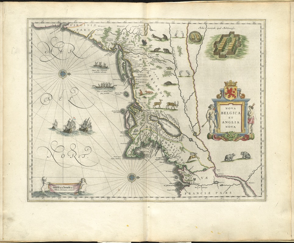
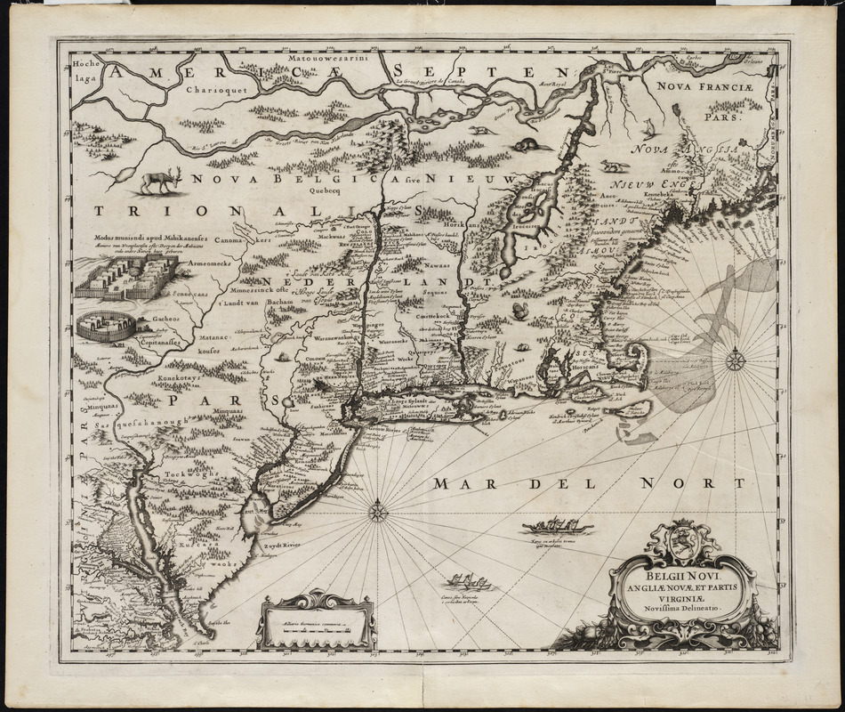
Finally, the map set presents another group of maps to have the viewer begin to hone their skills at analyzing the maps using their knowledge of proportionality. This last step provides two Dutch maps to begin this work. Connections and distinctions should be made between the English maps and the Dutch maps with reference to the size of different depictions.
This map set begins with an introduction to scale. Maps have three different categories for scale: small scale, medium scale, and large scale. The scope of this map set is to introduce an audience to the motivation for mapmakers to choose different scales. A viewer will consider the advantages for a mapmaker choosing a scale in terms of intention and design. Mathematical extensions include reasoning out the naming of scale, for example why "small scale" is called "small", using their knowledge of fraction comparisons. While this type of scale refers to how "zoomed in" objects appear in a map, it has obvious connections to how scale is used to describe distance on a map. While the distinction between the two should be made, students can reason about the relationship between the two scales.
The map set then goes on to introduce the styling choice of mapmakers in an English perspective. A viewer will be challenged to identify the exaggerated components of the map as well as downplayed components in service of understanding the English perspective. Maps of John Seller and John Smith are used to accomplish this goal, with the intention that the viewer notices the emphasis on resources in the map as well as the marginalization of indigenous people. In addition, the John Smith map is clearly focused on the Atlantic Ocean which shows its connections to navigation. Mathematical extensions of this activity could include calculating how big the wildlife would be in "real life" if they were as big as depicted on the map and looking at area comparisons of different territory as the English depicted.
Finally, the map set presents another group of maps to have the viewer begin to hone their skills at analyzing the maps using their knowledge of proportionality. This last step provides two Dutch maps to begin this work. Connections and distinctions should be made between the English maps and the Dutch maps with reference to the size of different depictions.