Toggle navigation
LMEC Home
Exhibitions
Georeferencing
Tools for Teachers
Collections
My Favorites
Sign Up / Log In
Search
Search the map portal
Map Collection
Map Collection
Map Sets
Search
Search
Search for
Search In
All Fields
Creator
Title
Subject
Place
Search All Digital Collections
Advanced Search
26 Results
My Search
Start Over
1936
Remove constraint 1936
Filter your Search
Place
North and Central America
20
United States
19
Boston
3
Providence (county)
3
Suffolk (county)
3
Asia
2
Berkshire (county)
2
Essex (county)
2
more
Place
»
Topic
Fire risk assessment
4
Insurance surveys
4
Textile factories
3
Boston (Mass.)--Maps
2
Arlington Mills
1
Asia, Central--Maps
1
Balkan Peninsula--Maps
1
Berkshire Hills (Mass.)--Maps
1
more
Topic
»
Date
Date range begin
–
Date range end
Current results range from
1831
to
1944
View distribution
Creator
Home Owners' Loan Corporation
3
Sampson, Murdock & Co.
3
Associated Factory Mutual Fire Insurance Companies
2
Associated Mutual Insurance Companies
1
Beck, Klir A.
1
Bell, A. I.
1
Boston (Mass.). City Planning Board
1
Boston Elevated Railway Company
1
more
Creator
»
Format
Maps/Atlases
26
Georeferenced
No
26
Collection
Norman B. Leventhal Map Center Collection
16
Boston and New England Maps
7
Urban Maps
6
American Textile History Museum Image Collection
4
Mapping Inequality Collection
3
Boston Redevelopment Authority Collection
1
Lucius Beebe Memorial Library Historic Maps
1
Town plans, 1830
1
Available to use
No known restrictions
19
Creative Commons license
3
Search Constraints
Sort by relevance
relevance
title
date (asc)
date (desc)
Number of results to display per page
20 per page
10
per page
20
per page
50
per page
100
per page
View results as:
grid view
map view
Search Results
1.
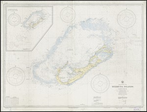
North Atlantic Ocean, Bermuda Islands : from British surveys to 1926, with additions and corrections to 1936
2.
[Map of Salem, Mass.]
3.
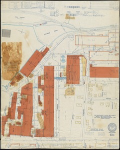
International Shoe Company and/or International Shoe Company of Massachusetts "Lake Factory" (Leather Shoe), Nashua, N.H....
4.
Caerte van de voornaemste reysen ende ontdeckingen door de Hollanders gedaen, alsook vande landen, plaetsen ende factoriën in...
5.
Arlington Mills (Worsted Cloth), Lawrence & Methuen, Mass.
6.
Plan of the town of Quebec, the capital of Canada in North America, with the Bason and a part of the adjacent country shewing...
7.
Boston thorofare plan existing routes and proposals
8.
H. W. Clark (Bldg.), H. W. Clark Company (Ten.) (Storage), North Adams, Mass. [insurance map]
9.
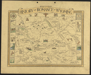
Map of the history and romance of Wyoming
10.
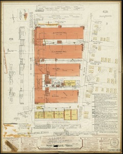
Passaic Cotton Mills "Rotch Dept." & "Penrod Dept.", New Bedford, Mass.
11.
Netherlands New Guinea : approximation of population distribution
12.
Santa Barbara National Forest, California (Monterey Division)
13.
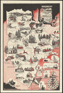
Olde York County Maine : published in commemoration of the 300th anniversary
14.
Boston Elevated Railway system map
15.
Index map of watersheds showing sanitary districts and bacteriological sampling stations
16.
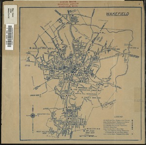
Wakefield, Massachusetts
17.
America : beauty, wonders, inspiration, progress, without end
18.
Property atlas of city of Lowell, northern district, Middlesex County, Massachusetts, showing the entire city complete in one...
19.
Winter sports map of the Berkshire Hills
20.
A New Yorker's idea of the United States of America
‹ Prev
Next ›
1
2
![[Map of Salem, Mass.]](https://bpldcassets.blob.core.windows.net/derivatives/images/commonwealth:8336h3099/image_thumbnail_300.jpg)
![International Shoe Company and/or International Shoe Company of Massachusetts "Lake Factory" (Leather Shoe), Nashua, N.H. [insurance map]](https://bpldcassets.blob.core.windows.net/derivatives/images/commonwealth:ww72c010t/image_thumbnail_300.jpg)


![H. W. Clark (Bldg.), H. W. Clark Company (Ten.) (Storage), North Adams, Mass. [insurance map]](https://bpldcassets.blob.core.windows.net/derivatives/images/commonwealth:9880vw94n/image_thumbnail_300.jpg)