Toggle navigation
LMEC Home
Exhibitions
Georeferencing
Tools for Teachers
Collections
My Favorites
Sign Up / Log In
Search
Search the map portal
Map Collection
Map Collection
Map Sets
Search
Search
Search for
Search In
All Fields
Creator
Title
Subject
Place
Search All Digital Collections
Advanced Search
8 Results
My Search
Start Over
grenadines
Remove constraint grenadines
Filter your Search
Place
North and Central America
8
Saint Vincent and the Grenadines
5
Saint Vincent Island
4
Bequia
3
Grenadines (county)
3
Admiralty Bay
1
Grenadine Islands
1
Topic
Saint Vincent--Maps--Early works to 1800
2
Admiralty Bay (Saint Vincent and the Grenadines)--Maps
1
Bequia Island (Saint Vincent and the Grenadines)--Maps
1
Bequia Island (Saint Vincent and the Grenadines)--Maps--Early works to 1800
1
Grenadines (Saint Vincent and the Grenadines and Grenada)--Maps
1
Nautical charts--Grenadines (Saint Vincent and the Grenadines and Grenada)
1
Nautical charts--Saint Vincent and the Grenadines--Admiralty Bay
1
Parishes--Saint Vincent--Maps--Early works to 1800
1
more
Topic
»
Date
Date range begin
–
Date range end
Current results range from
1775
to
1872
View distribution
Creator
Bayly, John Abraham, fl. 1755-1794
2
Byres, John
2
Hooper, S. (Samuel)
2
Jefferys, Thomas, -1771
2
Le Rouge, Georges-Louis
2
United States. Hydrographic Office
2
Jefferys, Thomas, d. 1771
1
Format
Maps/Atlases
8
Georeferenced
No
8
Collection
American Revolutionary War-Era Maps
6
Richard H. Brown Revolutionary War Map Collection at Mount Vernon
4
Norman B. Leventhal Map & Education Center Collection
3
Maritime Charts and Atlases
2
William L. Clements Library Collection
1
Available to use
Creative Commons license
4
No known restrictions
3
Search Constraints
Sort by relevance
relevance
title
date (asc)
date (desc)
Number of results to display per page
50 per page
10
per page
20
per page
50
per page
100
per page
View results as:
grid view
map view
Search Results
1.
West Indies, the Grenadines from Carriacou to Battowia : from a British survey in 1861, corrected to 1872
2.
West Indies, Grenadines--Id. of Bequia, Admiralty Bay : from British surveys, corrected to 1872
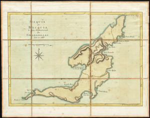
3.
Bequia ou Becouya, le plus septentrionale des Granadilles : levé en 1763
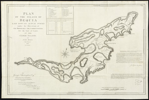
4.
Plan of the island of Bequia laid down by actual survey under the direction of the honorable the Commissioners for the Sale of...
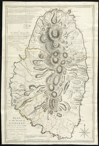
5.
Plan of the island of St. Vincent laid down by actual survey under the direction of the honorable the Commissioners for the...
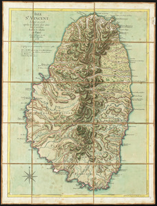
6.
Isle St. Vincent
7.
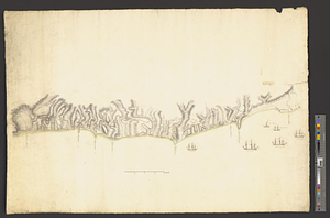
Southwest coast of St. Vincent
8.
St. Vincent, from an actual survey made in the year 1773 : after the treaty with the Caribs