Toggle navigation
LMEC Home
Exhibitions
Georeferencing
Tools for Teachers
Collections
My Favorites
Sign Up / Log In
Search
Search the map portal
Map Collection
Map Collection
Map Sets
Search
Search
Search for
Search In
All Fields
Creator
Title
Subject
Place
Search All Digital Collections
Advanced Search
1 Results
My Search
Start Over
barthľemy
Remove constraint barthľemy
Filter your Search
Place
West Indies
1
Topic
West Indies--Maps--Early works to 1800
1
Date
1750
1
Creator
Robert de Vaugondy, Gilles, 1688-1766
1
Format
Maps/Atlases
1
Georeferenced
Yes
1
Collection
American Revolutionary War-Era Maps
1
Norman B. Leventhal Map Center Collection
1
Available to use
No known restrictions
1
Search Constraints
Search for
bartol
or
bartel
or
barthe
or
barthé
or
bartal
instead?
Sort by relevance
relevance
title
date (asc)
date (desc)
Number of results to display per page
100 per page
10
per page
20
per page
50
per page
100
per page
View results as:
grid view
map view
Search Results
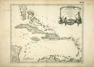
1.
Partie de la mer du Nord, où se trouvent les grandes et petites isles Antilles, et les isles Lucayes