Toggle navigation
LMEC Home
Exhibitions
Georeferencing
Tools for Teachers
Collections
My Favorites
Sign Up / Log In
Search
Search the map portal
Map Collection
Map Collection
Map Sets
Search
Search
Search for
Search In
All Fields
Creator
Title
Subject
Place
Search All Digital Collections
Advanced Search
150 Results
My Search
Start Over
1903
Remove constraint 1903
Filter your Search
Place
North and Central America
123
United States
69
Boston
36
Suffolk (county)
36
Oklahoma
10
Canada
8
Massachusetts
6
Middlesex (county)
5
more
Place
»
Topic
Boston (Mass.)--Maps
22
Landowners--Massachusetts--Boston--Maps
20
Indian reservations--Oklahoma--Maps
9
Indian Territory--Maps
7
Oklahoma--Maps
7
Boston (Mass.)--History--Colonial period, ca. 1600-1775--Maps
5
Homeowners--Massachusetts--Boston--Maps
5
Boston (Mass.)--Maps--Early works to 1800
4
more
Topic
»
Date
Date range begin
–
Date range end
Current results range from
1757
to
1999
View distribution
Creator
United States. Post Office Dept
34
Lamb, George
16
Olmsted, Frederick Law, 1822-1903
9
United States. Commission to the Five Civilized Tribes
8
Julius Bien & Co.
6
United States. Post Office Department
5
Lamb, George.
4
Norris Peters Co.
4
more
Creator
»
Format
Maps/Atlases
149
Manuscripts
2
Books
1
Objects/Artifacts
1
Georeferenced
Yes
21
No
129
Collection
Norman B. Leventhal Map Center Collection
143
Boston and New England Maps
32
Urban Maps
31
American Revolutionary War-Era Maps
5
Maritime Charts and Atlases
5
Mapping Boston Collection
2
Massachusetts Real Estate Atlases
2
American Textile History Museum Image Collection
1
more
Collection
»
Available to use
No known restrictions
143
Creative Commons license
4
Search Constraints
Sort by title
relevance
title
date (asc)
date (desc)
Number of results to display per page
20 per page
10
per page
20
per page
50
per page
100
per page
View results as:
grid view
map view
Search Results
121.
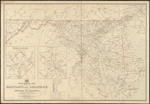
Post route map of the states of Maryland and Delaware and of the District of Columbia showing post offices with the...
122.
Post route map of the states of Massachusetts, Rhode Island, Connecticut showing post offices with the intermediate distances...
123.
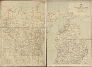
Post route map of the states of Michigan and Wisconsin showing post offices with the intermediate distances on mail routes in...
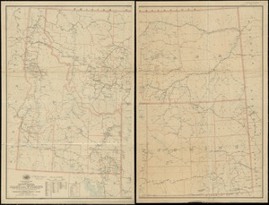
124.
Post route map of the states of Montana, Idaho and Wyoming showing post offices with the intermediate distances and mail routes...
125.
Post route map of the states of New Hampshire, Vermont showing post offices with the intermediate distances on mail routes in...
126.
Post route map of the states of North Carolina and South Carolina showing post offices with the intermediate distances and mail...
127.
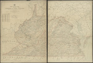
Post route map of the states of Virginia and West Virginia showing post offices with the intermediate distances on mail routes...
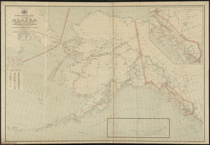
128.
Post route map of the territory of Alaska showing post offices and the intermediate distances on mail routes in operation on...
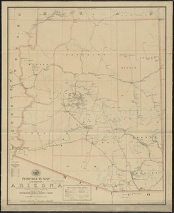
129.
Post route map of the territory of Arizona showing post offices with the intermediate distances and mail routes in operation on...
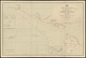
130.
Post route map of the territory of Hawaii, Samoan Islands and the island of Guam showing post offices in operation on the 1st...
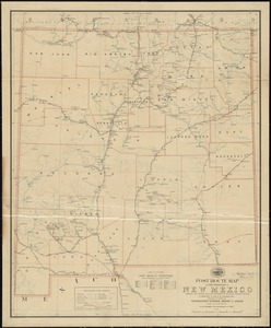
131.
Post route map of the territory of New Mexico showing post offices with the intermediate distances and mail routes in operation...
132.
Powder horn with hand-drawn map of the Hudson River (above Albany), Mohawk River, Niagara region, and Lake Ontario in New York...
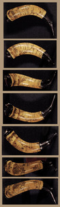
133.
Preliminary plan for the extension of Commonwealth Avenue along Beacon Street Brookline : showing connection with Chestnut Hill...
134.
Preliminary plan for widening Beacon Street from the Back Bay district of Boston to the public pleasure ground at Chestnut Hill...
135.
Preliminary study of a plan for a Pleasure Bay between Dorchester Point and Castle Island
136.
Proposed improvement of Back Bay
137.
Railway map of the British Isles
138.
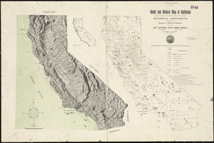
Relief and mineral map of California showing the topography and the approximate locations of all the principal mineral deposits...
139.
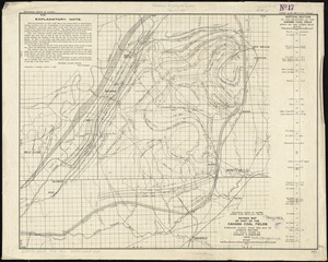
Revised map of part of the Cahaba coal fields
140.
Saskatchewan
‹ Prev
Next ›
1
2
3
4
5
6
7
8