Toggle navigation
LMEC Home
Exhibitions
Georeferencing
Tools for Teachers
Collections
My Favorites
Sign Up / Log In
Search
Search the map portal
Map Collection
Map Collection
Map Sets
Search
Search
Search for
Search In
All Fields
Creator
Title
Subject
Place
Search All Digital Collections
Advanced Search
134 Results
My Search
Start Over
1901
Remove constraint 1901
Filter your Search
Place
North and Central America
112
United States
79
Massachusetts
20
Cuba
12
Canada
9
New York
9
Boston
8
Hawaii
8
more
Place
»
Topic
United States--Maps
10
Havana (Cuba)--Maps
5
Coasts--Florida--Maps--Early works to 1800
4
Florida--Maps--Early works to 1800
4
Manuscript maps--Early works to 1800
4
Nautical charts--Florida--Early works to 1800
4
Roads--Cuba--Havana--Maps
4
Streets--Cuba--Havana--Maps
4
more
Topic
»
Date
Date range begin
–
Date range end
Current results range from
1696
to
1978
View distribution
Creator
United States. War Department
12
United States. Congress (56th, 2nd session : 1900-1901). Senate
10
United States. Congress. Senate. Committee on Foreign Relations
10
United States. Hydrographic Office
10
Enthoffer, J. (Joseph), 1818-1901
9
Colton, G. Woolworth (George Woolworth), 1827-1901
8
United States. Army. Department of Cuba
8
United States. Congress (56th, 2nd session : 1900-1901). House
8
more
Creator
»
Format
Maps/Atlases
131
Manuscripts
6
Prints
2
Documents
1
Georeferenced
Yes
12
No
122
Collection
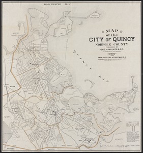
Norman B. Leventhal Map & Education Center Collection
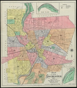
121
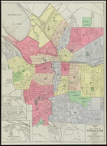
Maritime Charts and Atlases
13
Boston and New England Maps
10
Urban Maps
10
American Revolutionary War-Era Maps
7
Library of Congress Collection
6
David Judkins Weaver Papers
3
Ralph Finos Map Collection at Phillips Academy
2
more
Collection
»
Available to use
No known restrictions
125
Creative Commons license
7
Search Constraints
Sort by relevance
relevance
title
date (asc)
date (desc)
Number of results to display per page
20 per page
10
per page
20
per page
50
per page
100
per page
View results as:
grid view
map view
Search Results
101.
Ireland
102.
Uncle Sam's family tree
103.
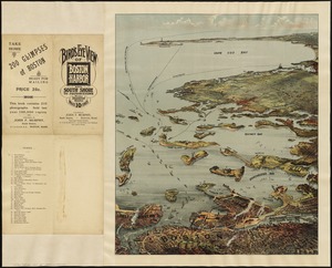
Bird's eye view of Boston Harbor and south shore to Provincetown showing steamboat routes
104.
Boston Harbor, Massachusetts
105.
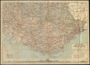
Cartes-guides Campbell Provence
106.
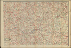
Cartes-guides Campbell Touraine, Orléanais, Anjou
107.
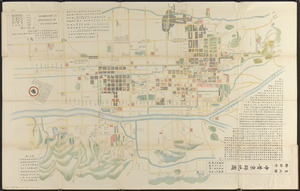
Chūseki keishi chizu
108.
Copia del Rio de Sn. Andres
109.
Geological map of Iceland
110.
Map of Massachusetts showing population according to United States Census of 1900 and congressional districts
111.
Map of the Brockton & Plymouth street railway
112.
Map of the cities of Albany and Rensselaer and portions of Bath and East Greenbrush, New York
113.
Map of the city of Boston and vicinity
114.
Map of the city of Quincy, Norfolk County
115.
Map of the city of Rochester
116.
Map of the City of Syracuse, New York
117.
Panama route, map showing location of proposed canal
118.
Rail road map of Pennsylvania
119.
Atlas of the city of Boston : East Boston
120.
Atlas of the city of Boston : Charlestown : from actual surveys and official plans
‹ Prev
Next ›
1
2
3
4
5
6
7