Toggle navigation
LMEC Home
Exhibitions
Georeferencing
Tools for Teachers
Collections
My Favorites
Sign Up / Log In
Search
Search the map portal
Map Collection
Map Collection
Map Sets
Search
Search
Search for
Search In
All Fields
Creator
Title
Subject
Place
Search All Digital Collections
Advanced Search
13385 Results
Filter your Search
Place
North and Central America
10,111
United States
8,249
Massachusetts
2,691
Suffolk (county)
1,664
Boston
1,621
Europe
1,386
Canada
949
New York
640
more
Place
»
Topic
Boston (Mass.)--Maps
741
City planning--Massachusetts--Boston--Maps
418
United States--History--Revolution, 1775-1783--Maps
329
United States--Maps
315
Urban renewal--Massachusetts--Boston--Maps
254
Real property--Massachusetts--Boston--Maps
252
Massachusetts--Maps
219
Insurance surveys
197
more
Topic
»
Date
Date range begin
–
Date range end
Current results range from
1482
to
2023
View distribution
Creator
United States. Hydrographic Office
595
Boston Redevelopment Authority
403
Des Barres, Joseph F. W. (Joseph Frederick Wallet), 1722-1824
247
Royal United Services Institute for Defence and Security Studies
160
Jefferys, Thomas, -1771
154
George, III, King of Great Britain, 1738-1820
152
George, IV, King of Great Britain, 1762-1830
151
O.H. Bailey & Co
148
more
Creator
»
Format
Maps/Atlases
13,205
Manuscripts
985
Prints
102
Books
49
Drawings/Illustrations
44
Photographs
15
Objects/Artifacts
13
Documents
7
more
Format
»
Georeferenced
Yes
979
No
12,406
Collection
Norman B. Leventhal Map & Education Center Collection
8,891
American Revolutionary War-Era Maps
3,305
Boston and New England Maps
2,804
Urban Maps
2,397
Maritime Charts and Atlases
1,150
William L. Clements Library Collection
910
Library of Congress Collection
618
Boston Redevelopment Authority Collection
475
more
Collection
»
Available to use
No known restrictions
9,952
Creative Commons license
1,677
Search Constraints
Sort by relevance
relevance
title
date (asc)
date (desc)
Number of results to display per page
20 per page
10
per page
20
per page
50
per page
100
per page
View results as:
grid view
map view
Search Results
10881.
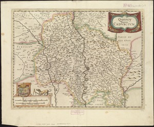
Quercy : Cadurcium
10882.
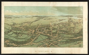
Quincy, Mass
10883.
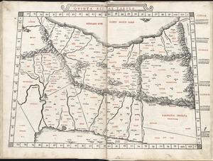
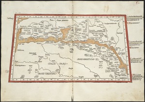
Quinta Asiae tabula
10884.
Quinta Asie tabula continet Assyriam, Susianam, Medos, Persidem, Hyrcaniam, Parthiam & Carmania desertam
10885.
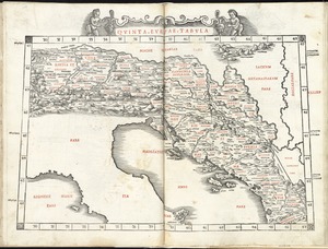
Quinta Europae tabula
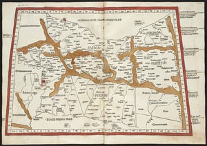
10886.
Quinta Europe tabula continet Rhetia
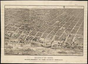
10887.
Qunicy in 1888 : supplement to the Quincy Herald
10888.
The races of Europe
10889.
Racine & Kenosha Counties, Wis.
10890.
Racing routes of the Yankee clippers
10891.
Rade et port de Plaisance -- Le Port d'Anapolis dans l'Acadie -- Port de Boston dans la Nouvlle. Angleterre
10892.
Radio map of the United States
10893.
Radiotelegraph and radiotelephone communication systems of France : radiotelegraph communication system of the French Ministry...
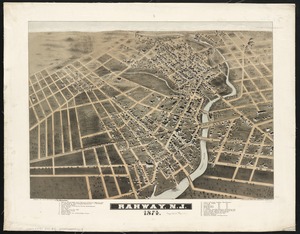
10894.
Rahway, N.J : 1874
10895.
The Rahway River valley, ca. 1780
10896.
Rail road map : showing the street rail road routes in and leading from Boston, with the terminus of each road in suburban...
10897.
Rail road map of New England & eastern New York
10898.
Rail road map of New England & eastern New York
10899.
Rail road map of Pennsylvania
10900.
Rail road map of Pennsylvania
‹ Prev
Next ›
1
2
…
541
542
543
544
545
546
547
548
549
…
669
670