Toggle navigation
LMEC Home
Exhibitions
Georeferencing
Tools for Teachers
Collections
My Favorites
Sign Up / Log In
Search
Search the map portal
Map Collection
Map Collection
Map Sets
Search
Search
Search for
Search In
All Fields
Creator
Title
Subject
Place
Search All Digital Collections
Advanced Search
13518 Results
My Search
Start Over
Date facet yearly ssim
1830
to
1834
Remove constraint Date facet yearly ssim: <span class='from'>1830</span> to <span class='to'>1834</span>
Filter your Search
Place
North and Central America
10,232
United States
8,367
Massachusetts
2,778
Suffolk (county)
1,675
Boston
1,631
Europe
1,386
Canada
949
New York
640
more
Place
»
Topic
Boston (Mass.)--Maps
746
City planning--Massachusetts--Boston--Maps
418
United States--History--Revolution, 1775-1783--Maps
329
United States--Maps
321
Real property--Massachusetts--Boston--Maps
254
Urban renewal--Massachusetts--Boston--Maps
254
Massachusetts--Maps
230
Insurance surveys
197
more
Topic
»
Date
Date range begin
–
Date range end
Current results range from
1482
to
2023
View distribution
Creator
United States. Hydrographic Office
596
Boston Redevelopment Authority
404
Des Barres, Joseph F. W. (Joseph Frederick Wallet), 1722-1824
247
Royal United Services Institute for Defence and Security Studies
160
Jefferys, Thomas, -1771
154
George, III, King of Great Britain, 1738-1820
152
George, IV, King of Great Britain, 1762-1830
151
O.H. Bailey & Co
148
more
Creator
»
Format
Maps/Atlases
13,337
Manuscripts
985
Prints
102
Books
49
Drawings/Illustrations
44
Photographs
15
Objects/Artifacts
13
Documents
7
more
Format
»
Georeferenced
Yes
979
No
12,539
Collection
Norman B. Leventhal Map & Education Center Collection
9,022
American Revolutionary War-Era Maps
3,305
Boston and New England Maps
2,900
Urban Maps
2,425
Maritime Charts and Atlases
1,167
William L. Clements Library Collection
910
Library of Congress Collection
618
Boston Redevelopment Authority Collection
475
more
Collection
»
Available to use
No known restrictions
10,085
Creative Commons license
1,677
Search Constraints
Sort by relevance
relevance
title
date (asc)
date (desc)
Number of results to display per page
20 per page
10
per page
20
per page
50
per page
100
per page
View results as:
grid view
map view
Search Results
8601.
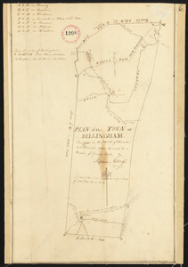
Plan of Bellingham made by Newell Nelson, dated September 1830
8602.
Plan of Bellingham made by Stephen Metcalf, dated December, 1794.
8603.
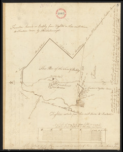
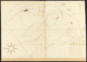
Plan of Berkley, surveyor's name not given, dated 1794-5.
8604.
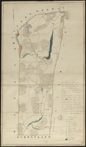
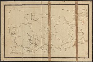
Plan of Berkley, surveyor's name not given, dated August 1830
8605.
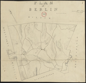
Plan of Berlin made by Henry Wilder, dated June 1830
8606.
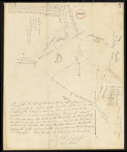
Plan of Berlin, made by Nathaniel Longley Jr., dated May, 1795.
8607.
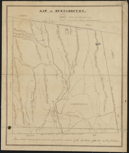
Plan of Bernardston made by Henry W. Cushman, dated October, 1830
8608.
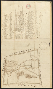
Plan of Bernardston, surveyor's name not given, dated November, 1794.
8609.
Plan of Berwick surveyor's name not given, dated February 13, 1795.
8610.
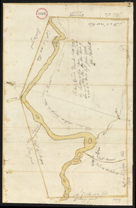
Plan of Bethel (Sudbury Canada) made by Eli Twitchell, dated December 18, 1795.
8611.
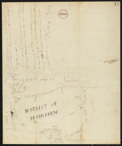
Plan of Bethlehem District (Otis) surveyed by Christopher Crary, dated April 8, 1795.
8612.
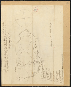
Plan of Beverly, made by Jonathan Smith, dated May 31, 1795.
8613.
Plan of Beverly made by T. Wilson Flagg, dated 1830
8614.
Plan of Biddeford, made by Partridge Richardson, dated 1794.
8615.
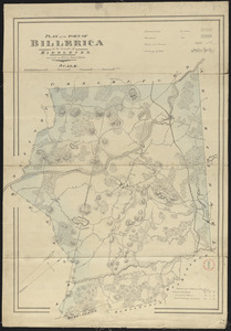
Plan of Billerica made by John G. Hales, dated 1831
8616.
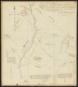
Plan of Billerica, made by Samuel Whiting, dated November, 1794.
8617.
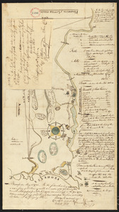
Plan of Bishop Parker's estate Bedford Street
8618.
A plan of Black River on the Mosquito shore : surveyed in 1779
8619.
Plan of Blandford made by Luke Barber, dated October 24, 1831
8620.
Plan of Blandford, surveyor's name not given, dated 1794-5.
‹ Prev
Next ›
1
2
…
427
428
429
430
431
432
433
434
435
…
675
676