Toggle navigation
LMEC Home
Exhibitions
Georeferencing
Tools for Teachers
Collections
My Favorites
Sign Up / Log In
Search
Search the map portal
Map Collection
Map Collection
Map Sets
Search
Search
Search for
Search In
All Fields
Creator
Title
Subject
Place
Search All Digital Collections
Advanced Search
13385 Results
Filter your Search
Place
North and Central America
9,353
United States
7,078
Suffolk (county)
1,664
Boston
1,621
Europe
1,035
Canada
949
Massachusetts
794
New York
532
more
Place
»
Topic
Boston (Mass.)--Maps
741
City planning--Massachusetts--Boston--Maps
418
United States--History--Revolution, 1775-1783--Maps
329
United States--Maps
315
Urban renewal--Massachusetts--Boston--Maps
254
Real property--Massachusetts--Boston--Maps
252
Massachusetts--Maps
219
Insurance surveys
197
more
Topic
»
Date
Date range begin
–
Date range end
Current results range from
1482
to
2023
View distribution
Creator
United States. Hydrographic Office
595
Boston Redevelopment Authority
403
Des Barres, Joseph F. W. (Joseph Frederick Wallet), 1722-1824
247
Royal United Services Institute for Defence and Security Studies
160
Jefferys, Thomas, -1771
154
George, III, King of Great Britain, 1738-1820
152
George, IV, King of Great Britain, 1762-1830
151
O.H. Bailey & Co
148
more
Creator
»
Format
Maps/Atlases
13,205
Manuscripts
985
Prints
102
Books
49
Drawings/Illustrations
44
Photographs
15
Objects/Artifacts
13
Documents
7
more
Format
»
Georeferenced
Yes
979
No
12,406
Collection
Norman B. Leventhal Map Center Collection
8,891
American Revolutionary War-Era Maps
3,305
Boston and New England Maps
2,804
Urban Maps
2,397
Maritime Charts and Atlases
1,150
William L. Clements Library Collection
910
Library of Congress Collection
618
Boston Redevelopment Authority Collection
475
more
Collection
»
Available to use
No known restrictions
9,952
Creative Commons license
1,677
Search Constraints
Sort by date (desc)
relevance
title
date (asc)
date (desc)
Number of results to display per page
20 per page
10
per page
20
per page
50
per page
100
per page
View results as:
grid view
map view
Search Results
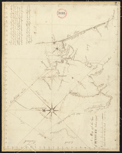
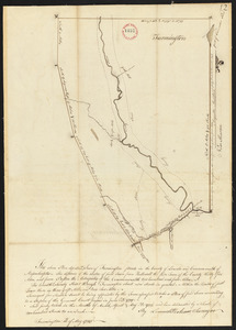
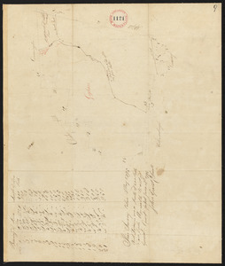
8461.
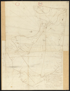
Plan of Duxbury surveyed by Alden Benjamin, dated 1795.
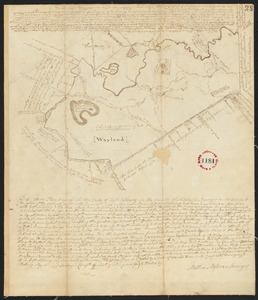
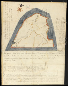
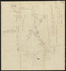
8462.
Plan of East Sudbury (Wayland) surveyed by Matthias Mossman, dated May 21, 1795.
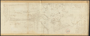
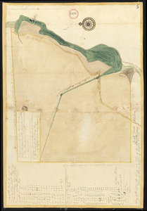
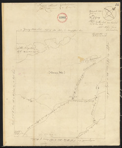
8463.
Plan of Eastham, surveyor's name not given, dated May 22, 1795.
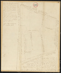
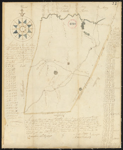
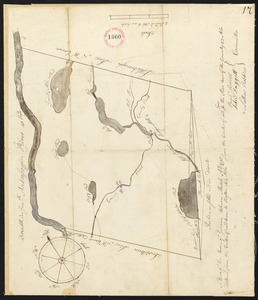
8464.
Plan of Easton, made by Nathan Selee, dated May 29, 1795.
8465.
Plan of Edgartown and Tisbury, made by Benjamin Smith, dated June 1, 1795.
8466.
Plan of Elizabeth Islands, etc. (Chilmark), surveyor's name not given, dated May 27, 1795.
8467.
Plan of Fairfield, made by Abraham Sanders, dated May 11, 1795.
8468.
Plan of Falmouth, surveyor's name not given, dated May 20, 1795.
8469.
Plan of Farmington, made by Lemuel Perham, dated May, 1795.
8470.
Plan of Foxborough surveyed by Aaron Everett, dated 1795.
8471.
Plan of Frankfort made by Eliashib Delano, dated May 19, 1795.
8472.
Plan of Franklin made by Amos Hawes and Moses Fisher, dated May 27, 1795.
8473.
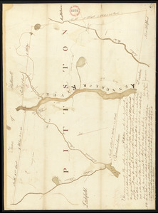
Plan of Gardiner and Pittston made by Ephraim Ballard and Sylvester Moore, dated April, 1795.
8474.
Plan of Gardner and Templeton, made by Samuel Cook, dated May, 1795.
8475.
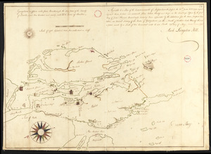
Plan of Georgetown, Me., made by Mark L Hill, dated May 25, 1795.
8476.
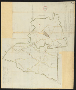
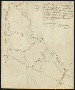
Plan of Gerry (Phillipston) surveyed by Charles Baker and Gardner Maynard, dated March, 1795.
8477.
Plan of Goshen made by John Grant, dated May, 1795.
8478.
Plan of Grafton, surveyor's name not given, dated May 20, 1795.
8479.
Plan of Gray, Me. (New Boston), made by Nathaniel Wilson, dated June 19, 1795.
8480.
Plan of Greene, Maine, surveyor's name not given, dated March, 1795.
‹ Prev
Next ›
1
2
…
420
421
422
423
424
425
426
427
428
…
669
670