Toggle navigation
LMEC Home
Exhibitions
Georeferencing
Tools for Teachers
Collections
My Favorites
Sign Up / Log In
Search
Search the map portal
Map Collection
Map Collection
Map Sets
Search
Search
Search for
Search In
All Fields
Creator
Title
Subject
Place
Search All Digital Collections
Advanced Search
13680 Results
My Search
Start Over
Date facet yearly ssim
1685
to
1689
Remove constraint Date facet yearly ssim: <span class='from'>1685</span> to <span class='to'>1689</span>
Filter your Search
Place
North and Central America
10,344
United States
8,475
Massachusetts
2,789
Suffolk (county)
1,677
Boston
1,633
Europe
1,415
Canada
950
New York
649
more
Place
»
Topic
Boston (Mass.)--Maps
747
City planning--Massachusetts--Boston--Maps
418
United States--History--Revolution, 1775-1783--Maps
329
United States--Maps
322
Real property--Massachusetts--Boston--Maps
254
Urban renewal--Massachusetts--Boston--Maps
254
Massachusetts--Maps
231
Insurance surveys
197
more
Topic
»
Date
Date range begin
–
Date range end
Current results range from
1482
to
2023
View distribution
Creator
United States. Hydrographic Office
597
Boston Redevelopment Authority
404
Des Barres, Joseph F. W. (Joseph Frederick Wallet), 1722-1824
247
Royal United Services Institute for Defence and Security Studies
160
Jefferys, Thomas, -1771
154
George, III, King of Great Britain, 1738-1820
152
George, IV, King of Great Britain, 1762-1830
151
O.H. Bailey & Co
148
more
Creator
»
Format
Maps/Atlases
13,499
Manuscripts
985
Prints
102
Books
49
Drawings/Illustrations
44
Photographs
15
Objects/Artifacts
13
Documents
7
more
Format
»
Georeferenced
Yes
979
No
12,701
Collection
Norman B. Leventhal Map & Education Center Collection
9,096
American Revolutionary War-Era Maps
3,305
Boston and New England Maps
2,915
Urban Maps
2,471
Maritime Charts and Atlases
1,169
William L. Clements Library Collection
910
Library of Congress Collection
618
Boston Redevelopment Authority Collection
475
more
Collection
»
Available to use
No known restrictions
10,246
Creative Commons license
1,678
Search Constraints
Sort by relevance
relevance
title
date (asc)
date (desc)
Number of results to display per page
20 per page
10
per page
20
per page
50
per page
100
per page
View results as:
grid view
map view
Search Results
8021.
Parcel D-10
8022.
Parcel post map of the United States
8023.
Paris
8024.
Paris illustré et ses fortifications
8025.
Paris monumental et ses environs
8026.
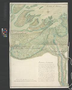
Parish of Batiscant. Parish of St. Pierre Becquet. Parish of Champlain. Parish of Gentilly
8027.
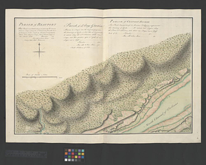
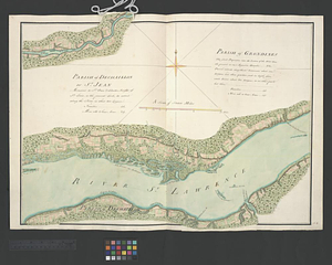
Parish of Beauport. Parish of L'Ange Gardien. Parish of Chateau Richer
8028.
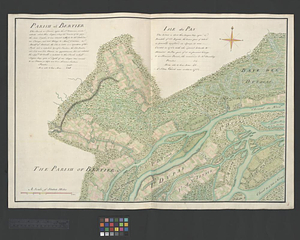
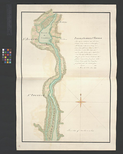
Parish of Berthier. Parish of St. François. Parish of St. Thomas
8029.
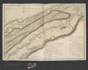
Parish of Bertier. Isle du Pas
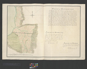
8030.
Parish of Boucherville. Parish de la Magdelaine. Parish of La Prairie
8031.
Parish of Chambly & Ste. Therese
8032.
Parish of Charlebourgh
8033.
Parish of Chateau Gay
8034.
Parish of Dechaillon or St. Jean. Parish of Grondines
8035.
Parish of Dechambeaux. Parish of Cape Sante. Parish of Lotbinière. Parish of St. Croix
8036.
Parish of Iamaska
8037.
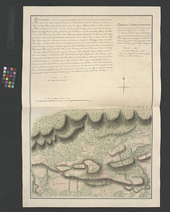
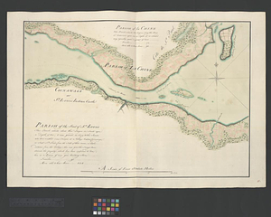
Parish of La Chine. Parish of the Saut of St. Louis. Cocnawaga or St. Louis Indian Castle
8038.
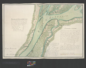
Parish of La Norray & Dautray. Parish of Sorrel
8039.
Parish of L'Assomption. Parish of St. Sulpice
8040.
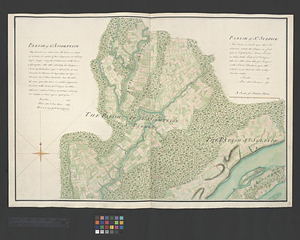
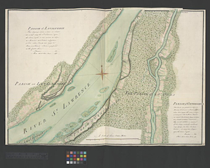
Parish of Lavalterie. Parish of Contrecoeur
‹ Prev
Next ›
1
2
…
398
399
400
401
402
403
404
405
406
…
683
684