Toggle navigation
LMEC Home
Exhibitions
Georeferencing
Tools for Teachers
Collections
My Favorites
Sign Up / Log In
Search
Search the map portal
Map Collection
Map Collection
Map Sets
Search
Search
Search for
Search In
All Fields
Creator
Title
Subject
Place
Search All Digital Collections
Advanced Search
13680 Results
My Search
Start Over
Date facet yearly ssim
1550
to
1599
Remove constraint Date facet yearly ssim: <span class='from'>1550</span> to <span class='to'>1599</span>
Filter your Search
Place
North and Central America
10,344
United States
8,475
Massachusetts
2,789
Suffolk (county)
1,677
Boston
1,633
Europe
1,415
Canada
950
New York
649
more
Place
»
Topic
Boston (Mass.)--Maps
747
City planning--Massachusetts--Boston--Maps
418
United States--History--Revolution, 1775-1783--Maps
329
United States--Maps
322
Real property--Massachusetts--Boston--Maps
254
Urban renewal--Massachusetts--Boston--Maps
254
Massachusetts--Maps
231
Insurance surveys
197
more
Topic
»
Date
Date range begin
–
Date range end
Current results range from
1482
to
2023
View distribution
Creator
United States. Hydrographic Office
597
Boston Redevelopment Authority
404
Des Barres, Joseph F. W. (Joseph Frederick Wallet), 1722-1824
247
Royal United Services Institute for Defence and Security Studies
160
Jefferys, Thomas, -1771
154
George, III, King of Great Britain, 1738-1820
152
George, IV, King of Great Britain, 1762-1830
151
O.H. Bailey & Co
148
more
Creator
»
Format
Maps/Atlases
13,499
Manuscripts
985
Prints
102
Books
49
Drawings/Illustrations
44
Photographs
15
Objects/Artifacts
13
Documents
7
more
Format
»
Georeferenced
Yes
979
No
12,701
Collection
Norman B. Leventhal Map & Education Center Collection
9,096
American Revolutionary War-Era Maps
3,305
Boston and New England Maps
2,915
Urban Maps
2,471
Maritime Charts and Atlases
1,169
William L. Clements Library Collection
910
Library of Congress Collection
618
Boston Redevelopment Authority Collection
475
more
Collection
»
Available to use
No known restrictions
10,246
Creative Commons license
1,678
Search Constraints
Sort by relevance
relevance
title
date (asc)
date (desc)
Number of results to display per page
20 per page
10
per page
20
per page
50
per page
100
per page
View results as:
grid view
map view
Search Results
7821.
Nov[us] orbis sive America septentrionalis, divisa per sua regna provinc. et insul : cura et opera
7822.
Now see America by Grace Line
7823.
Nowel Amsterdam en Lamerique : 1672
7824.
Nth. America
7825.
Nuclear America
7826.
The nuclear weapons complex transportation routes
7827.
Nuevo mapa de Mexico
7828.
Nuevo plano de Puerto Rico
7829.
Nunan's map of Ashland Co., Ohio : showing the sections, farms, lots, & villages
7830.
La Nuoua Francia
7831.
Nuoua pianta eleuata della nobile e cospicua citta di Venezia
7832.
Nuova carta dell'Italia
7833.
La Nuova Francia
7834.
La Nuova Francia
7835.
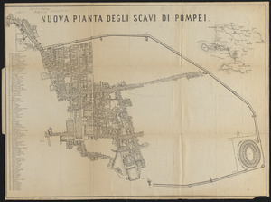
Nuova pianta degli scavi di Pompei
7836.
Nuova pianta degli scavi di Pompei
7837.
Nuova pianta della cittá e porto franco di Venezia
7838.
Nuova pianta di Roma moderna : estratta dalla grande del Nolli corretta ed accresciuta de' nomi delle contrade indicati al loro...
7839.
Nuova pianta di Venezia = Neuer plan von Venedig
7840.
N.w. coast of Peru, Ferrol Bay & Port Chimbote
‹ Prev
Next ›
1
2
…
388
389
390
391
392
393
394
395
396
…
683
684
![Nov[us] orbis sive America septentrionalis, divisa per sua regna provinc. et insul](https://bpldcassets.blob.core.windows.net/derivatives/images/commonwealth:wd376505f/image_thumbnail_300.jpg)