Toggle navigation
LMEC Home
Exhibitions
Georeferencing
Tools for Teachers
Collections
My Favorites
Sign Up / Log In
Search
Search the map portal
Map Collection
Map Collection
Map Sets
Search
Search
Search for
Search In
All Fields
Creator
Title
Subject
Place
Search All Digital Collections
Advanced Search
14164 Results
Filter your Search
Place
North and Central America
10,811
United States
8,818
Massachusetts
2,820
Suffolk (county)
1,688
Boston
1,644
Europe
1,428
Canada
1,010
New York
683
more
Place
»
Topic
Boston (Mass.)--Maps
753
City planning--Massachusetts--Boston--Maps
419
United States--History--Revolution, 1775-1783--Maps
331
United States--Maps
331
Real property--Massachusetts--Boston--Maps
254
Urban renewal--Massachusetts--Boston--Maps
254
North America--Maps--Early works to 1800
241
Massachusetts--Maps
236
more
Topic
»
Date
Date range begin
–
Date range end
Current results range from
1482
to
2023
View distribution
Creator
United States. Hydrographic Office
597
Boston Redevelopment Authority
404
Des Barres, Joseph F. W. (Joseph Frederick Wallet), 1722-1824
247
Jefferys, Thomas, -1771
172
United States. National Ocean Service
170
Royal United Services Institute for Defence and Security Studies
160
George, III, King of Great Britain, 1738-1820
152
George, IV, King of Great Britain, 1762-1830
151
more
Creator
»
Format
Maps/Atlases
13,978
Manuscripts
985
Prints
102
Books
53
Drawings/Illustrations
44
Photographs
15
Objects/Artifacts
13
Documents
7
more
Format
»
Georeferenced
Yes
979
No
13,185
Collection
Norman B. Leventhal Map & Education Center Collection
9,162
American Revolutionary War-Era Maps
3,629
Boston and New England Maps
2,936
Urban Maps
2,511
Maritime Charts and Atlases
1,169
William L. Clements Library Collection
910
Library of Congress Collection
618
Boston Redevelopment Authority Collection
475
more
Collection
»
Available to use
No known restrictions
10,408
Creative Commons license
1,678
Search Constraints
Sort by relevance
relevance
title
date (asc)
date (desc)
Number of results to display per page
20 per page
10
per page
20
per page
50
per page
100
per page
View results as:
grid view
map view
Search Results
7461.
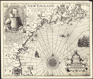
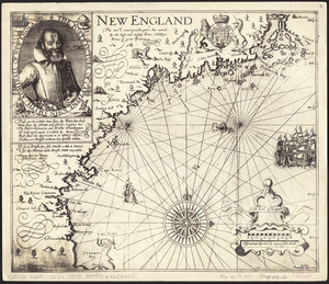
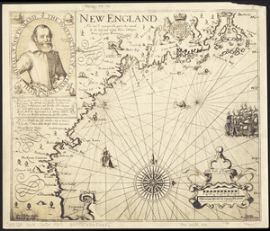
New England : the most remarqueable parts thus named by the high and mighty Prince Charles, Prince of great Britaine
7462.
New England : the most remarqueable parts thus named by the high and mighty Prince Charles, Prince of great Britaine
7463.
New England : the most remarqueable parts thus named by the high and mighty Prince Charles, Prince of great Britaine
7464.
New England : the most remarqueable parts thus named by the high and mighty Prince Charles, Prince of great Britaine
7465.
New England : the most remarqueable parts thus named by the high and mighty Prince Charles, Prince of great Britaine
7466.
New England : the most remarqueable parts thus named by the high and mighty Prince Charles, nowe King of great Britaine
7467.
New England
7468.
New England and New York
7469.
New England and New York
7470.
New England and New York in 1697
7471.
New England Briar Pipe Company and/or The Reiss-Premier Corporation and/or New England Brush Company, Inc., Penacook, N.H....
7472.
The New England commercial and route survey : showing all postoffices, railroads, electric roads in operation and proposed,...
7473.
The New England commercial and route survey
7474.
New England Cotton Yarn Co., Bennett Department, "Depts. Nos. 1, 5, 3A & 2," New Bedford, Mass. [insurance map]
7475.
New England fishery management region
7476.
New England fishery, recreation and scenic resources
7477.
New England, New York, New Jersey and Pensilvania
7478.
New England recreationland: Maine, New Hampshire, Vermont, Massachusetts, Rhode Island, Connecticut
7479.
New England regional transportation map = Mapa do transporte regional da Nova Inglaterra = Nueva Inglaterra, mapa regional de...
7480.
The New England states and part of Canada
‹ Prev
Next ›
1
2
…
370
371
372
373
374
375
376
377
378
…
708
709


![New England Briar Pipe Company and/or The Reiss-Premier Corporation and/or New England Brush Company, Inc., Penacook, N.H. [insurance map]](https://bpldcassets.blob.core.windows.net/derivatives/images/commonwealth:ww72c022m/image_thumbnail_300.jpg)


![New England Cotton Yarn Co., Bennett Department, "Depts. Nos. 1, 5, 3A & 2," New Bedford, Mass. [insurance map]](https://bpldcassets.blob.core.windows.net/derivatives/images/commonwealth:ww72bz740/image_thumbnail_300.jpg)