Toggle navigation
LMEC Home
Exhibitions
Georeferencing
Tools for Teachers
Collections
My Favorites
Sign Up / Log In
Search
Search the map portal
Map Collection
Map Collection
Map Sets
Search
Search
Search for
Search In
All Fields
Creator
Title
Subject
Place
Search All Digital Collections
Advanced Search
99 Results
My Search
Start Over
Date
1932
Remove constraint Date: <span class='single'>1932</span>
Filter your Search
Place
North and Central America
96
United States
95
Massachusetts
7
Boston
6
New England
6
Suffolk (county)
6
Canada
3
Asia
2
more
Place
»
Topic
United States--Maps
72
Elections--United States--Maps
33
Population density--United States--Maps
14
Suffrage--United States--Maps
6
Voting--United States--Maps
6
Public Lands--United States--Maps
4
Women--Suffrage--United States--Maps
4
New England--Maps--Early works to 1800--Facsimiles
3
more
Topic
»
Date
1932
[remove]
99
Date range begin
–
Date range end
Current results range from
1770
to
1999
1932
to
1932
99
Creator
Paullin, Charles Oscar, 1868 or 1869-1944
70
Wright, John Kirtland, 1891-1969
70
American Automobile Association
1
Associated Factory Mutual Fire Insurance Companies
1
Boston (Mass.). Department of Parks. Board of Commissioners
1
Clegg, Ernest
1
Davis, Thomas W., surveyor
1
Dow, William J.
1
more
Creator
»
Format
Maps/Atlases
97
Photographs
2
Georeferenced
Yes
24
No
75
Collection
Norman B. Leventhal Map & Education Center Collection
94
Boston and New England Maps
3
Urban Maps
3
American Revolutionary War-Era Maps
1
American Textile History Museum Image Collection
1
Lucius Beebe Memorial Library Historic Maps
1
Massachusetts Real Estate Atlases
1
Robert E. Diefenbach Map Collection at Phillips Academy
1
more
Collection
»
Available to use
No known restrictions
24
Creative Commons license
2
Search Constraints
Sort by relevance
relevance
title
date (asc)
date (desc)
Number of results to display per page
20 per page
10
per page
20
per page
50
per page
100
per page
View results as:
grid view
map view
Search Results
41.
Outline map of Massachusetts showing boundaries of towns and counties in tidal water
42.
Pilot chart of New York Bay and Harbor for use with Krause's New York pilot courses
43.
Plan of corner of Centry & Beacon St's -- 1741
44.
Plan of the burnt district : showing proposed improvements in streets. Nov. 12th 1872
45.
Portland also called Falmouth first settled 1632 chartered as a city 1832
46.
Present continental United States, except Alaska, as it appeared in 1609
47.
Presidential and other elections, 1800
48.
Presidential and other elections, 1804
49.
Presidential and other elections, 1808
50.
Presidential and other elections, 1812
51.
Presidential and other elections, 1816
52.
Presidential election 1820
53.
Presidential election 1824
54.
Presidential election 1828
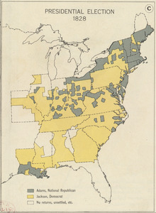
55.
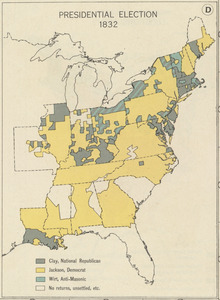
Presidential election 1832
56.
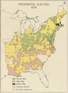
Presidential election 1836
57.
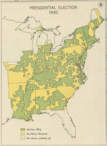
Presidential election 1840
58.
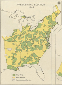
Presidential election 1844
59.
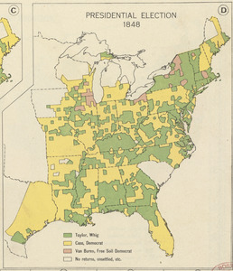
Presidential election 1848
60.
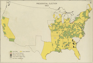
Presidential election 1852
‹ Prev
Next ›
1
2
3
4
5