Toggle navigation
LMEC Home
Exhibitions
Georeferencing
Tools for Teachers
Collections
My Favorites
Sign Up / Log In
Search
Search the map portal
Map Collection
Map Collection
Map Sets
Search
Search
Search for
Search In
All Fields
Creator
Title
Subject
Place
Search All Digital Collections
Advanced Search
62 Results
My Search
Start Over
Date
1921
Remove constraint Date: <span class='single'>1921</span>
Filter your Search
Place
North and Central America
51
United States
45
Massachusetts
11
Boston
10
Suffolk (county)
10
Canada
7
New England
6
Europe
5
more
Place
»
Topic
Fire risk assessment
7
Insurance surveys
7
Textile factories
7
Boston (Mass.)--Maps
4
Cotton manufacture
3
New England--Maps--Early works to 1800--Facsimiles
3
Woolen and worsted manufacture
3
Hiking--Vermont--Long Trail--Maps
2
more
Topic
»
Date
1921
[remove]
62
Date range begin
–
Date range end
Current results range from
1770
to
1999
1921
to
1921
62
Creator
Associated Mutual Insurance Companies
3
Canada. Natural Resources Intelligence Branch
3
Pusey, Lewis B.
3
Richardson, G. B. (George Burr), 1872-1949
3
Associated Factory Mutual Fire Insurance Companies
2
C.S. Hammond & Company
2
Congdon, Herbert Wheaton, 1876-1965
2
Edinburgh Geographical Institute
2
more
Creator
»
Format
Maps/Atlases
61
Photographs
1
Georeferenced
Yes
2
No
60
Collection
Norman B. Leventhal Map & Education Center Collection
51
American Textile History Museum Image Collection
7
Urban Maps
3
Boston and New England Maps
2
Massachusetts Real Estate Atlases
2
American Revolutionary War-Era Maps
1
Robert E. Diefenbach Map Collection at Phillips Academy
1
Sidney R. Knafel Map Collection at Phillips Academy
1
Available to use
No known restrictions
51
Creative Commons license
1
Search Constraints
Sort by relevance
relevance
title
date (asc)
date (desc)
Number of results to display per page
20 per page
10
per page
20
per page
50
per page
100
per page
View results as:
grid view
map view
Search Results
41.
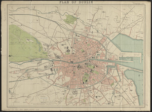
Plan of Dublin
42.
Plan of the burnt district : showing proposed improvements in streets. Nov. 12th 1872
43.
Political map of Europe
44.
The Price & Lee Co's new map of the city of Holyoke and part of the city of Chicopee, Mass
45.
Public reservations on the banks of the Charles River between Watertown and Cragies Bridge
46.
The Rand-McNally map of the city of Havana showing suburbs, parks, forts, and principal buildings
47.
R.L. Polk & Co.'s map of Bay City, and Essexville Mich
48.
R.L. Polk & Co's map of greater Battle Creek and suburbs
49.
Saskatchewan : map showing disposition of lands
50.
A small map of the sea coast of New England together with the outlines of several of the provinces lying thereon, 1738
51.
South Boston
52.
The south part of New-England, as it is planted this yeare, 1635
53.
Southern Alberta : map showing disposition of lands
54.
The Standard Textile Products Co., Inc., Rock Island, Ill. [insurance map]
55.
Street index map of Oakland, Albany, Berkeley, Emeryville, Piedmont, Alameda, San Leandro, Alameda Co., California
56.
Street map of the city of Mount Vernon and the town of Pelham, Westchester County, N.Y
57.
To his excellency William Shirley Esqr., Captain General and Commander in Chief, in and over his Majesty's province of the...
58.
Town of Nahant
59.
Travel-map of New England
60.
Whitman Mills (Cotton Mill), New Bedford, Mass. [insurance map]
‹ Prev
Next ›
1
2
3
4


![The Standard Textile Products Co., Inc., Rock Island, Ill. [insurance map]](https://bpldcassets.blob.core.windows.net/derivatives/images/commonwealth:2r36vc76n/image_thumbnail_300.jpg)


![Whitman Mills (Cotton Mill), New Bedford, Mass. [insurance map]](https://bpldcassets.blob.core.windows.net/derivatives/images/commonwealth:ww72c001v/image_thumbnail_300.jpg)