Toggle navigation
LMEC Home
Exhibitions
Georeferencing
Tools for Teachers
Collections
My Favorites
Sign Up / Log In
Search
Search the map portal
Map Collection
Map Collection
Map Sets
Search
Search
Search for
Search In
All Fields
Creator
Title
Subject
Place
Search All Digital Collections
Advanced Search
14164 Results
Filter your Search
Place
North and Central America
10,832
United States
8,868
Massachusetts
2,832
Suffolk (county)
1,688
Boston
1,644
Europe
1,428
Canada
1,010
New York
684
more
Place
»
Topic
Boston (Mass.)--Maps
753
City planning--Massachusetts--Boston--Maps
419
United States--History--Revolution, 1775-1783--Maps
331
United States--Maps
331
Real property--Massachusetts--Boston--Maps
254
Urban renewal--Massachusetts--Boston--Maps
254
North America--Maps--Early works to 1800
241
Massachusetts--Maps
236
more
Topic
»
Date
Date range begin
–
Date range end
Current results range from
1482
to
2023
View distribution
Creator
United States. Hydrographic Office
597
Boston Redevelopment Authority
404
Des Barres, Joseph F. W. (Joseph Frederick Wallet), 1722-1824
247
Jefferys, Thomas, -1771
172
United States. National Ocean Service
170
Royal United Services Institute for Defence and Security Studies
160
George, III, King of Great Britain, 1738-1820
152
George, IV, King of Great Britain, 1762-1830
151
more
Creator
»
Format
Maps/Atlases
13,978
Manuscripts
985
Prints
102
Books
53
Drawings/Illustrations
44
Photographs
15
Objects/Artifacts
13
Documents
7
more
Format
»
Georeferenced
Yes
979
No
13,185
Collection
Norman B. Leventhal Map & Education Center Collection
9,162
American Revolutionary War-Era Maps
3,629
Boston and New England Maps
2,936
Urban Maps
2,511
Maritime Charts and Atlases
1,169
William L. Clements Library Collection
910
Library of Congress Collection
618
Boston Redevelopment Authority Collection
475
more
Collection
»
Available to use
No known restrictions
10,408
Creative Commons license
1,678
Search Constraints
Sort by relevance
relevance
title
date (asc)
date (desc)
Number of results to display per page
20 per page
10
per page
20
per page
50
per page
100
per page
View results as:
grid view
map view
Search Results
4961.
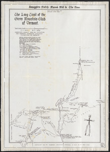
The Long Trail of the Green Mountain Club of Vermont : Smuggler's Notch: Morse's Mill to the Nose
4962.
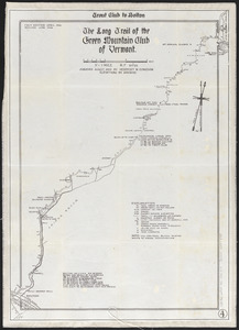
The Long Trail of the Green Mountain Club of Vermont : Trout Club to Bolton
4963.
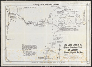
The Long Trail of the Green Mountain Club of Vermont : Monroe Skyline section: Couching Lion to Burnt Rock Mountain
4964.
Long Wharf DEM/BRA master plan : master plan scheme
4965.
Long Wharf DEM/BRA master plan : proposed dredging scheme
4966.
Long Wharf phase II illustrative plan
4967.
Longwood Medical Area
4968.
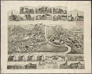
Lonsdale, Rhode Island : 1888
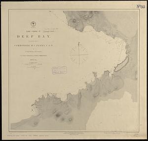
4969.
Loo Choo Id., Deep Bay
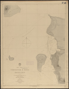
4970.
(Loo Choo) Tubootch & Suco Harbors
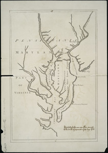
4971.
Lord Baltimore's own plan : proposed Maryland/Pennsylvania boundary
4972.
Lord Cornwallis surrender, 1781
4973.
Lorraine
4974.
Lorraine Mfg. Co. (Cotton & Worsted Mill), Pawtucket, R.I. [insurance map]
4975.
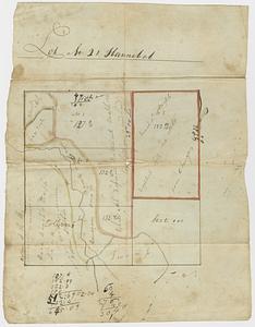
Lot no. 21 Hannibal
4976.
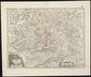
Lotharingia ducatus noua descriptio
4977.
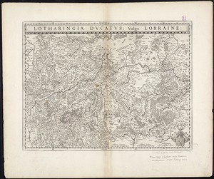
Lotharingia Ducatus, vulgo Lorraine
4978.
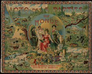
Loto des 5 parties du monde : races humaines, productions, vegetales et animales [cover]
4979.
Louisbourg, latitude 45⁰ 50' north
4980.
Louisiana
‹ Prev
Next ›
1
2
…
245
246
247
248
249
250
251
252
253
…
708
709


![Lorraine Mfg. Co. (Cotton & Worsted Mill), Pawtucket, R.I. [insurance map]](https://bpldcassets.blob.core.windows.net/derivatives/images/commonwealth:2r36vc298/image_thumbnail_300.jpg)