Toggle navigation
LMEC Home
Exhibitions
Georeferencing
Tools for Teachers
Collections
My Favorites
Sign Up / Log In
Search
Search the map portal
Map Collection
Map Collection
Map Sets
Search
Search
Search for
Search In
All Fields
Creator
Title
Subject
Place
Search All Digital Collections
Advanced Search
105 Results
My Search
Start Over
Date
1918
Remove constraint Date: <span class='single'>1918</span>
Filter your Search
Place
North and Central America
43
Europe
41
United States
39
Asia
9
Massachusetts
9
France
8
Canada
7
Africa
6
more
Place
»
Topic
France--Maps
6
Hungary--Maps
6
Austria--Maps
5
Balkan Peninsula--Maps
5
Hiking--Vermont--Maps
5
Long Trail (Vt.)--Maps
5
Trails--Vermont--Maps
5
Europe, Central--Maps
4
more
Topic
»
Date
1918
[remove]
105
Date range begin
–
Date range end
Current results range from
1770
to
1999
1918
to
1918
105
Creator
American Geographical Society of New York
34
Congdon, Herbert Wheaton, 1876-1965
5
C.S. Hammond & Company
4
Gross, Alexander, 1879-1958
3
Bromley, George Washington
2
Bromley, Walter Scott
2
Canada. Natural Resources Intelligence Branch
2
Kelly's Directories Ltd.
2
more
Creator
»
Format
Maps/Atlases
104
Photographs
1
Georeferenced
Yes
7
No
98
Collection
Norman B. Leventhal Map & Education Center Collection
99
Boston and New England Maps
3
Massachusetts Real Estate Atlases
3
Urban Maps
3
American Revolutionary War-Era Maps
1
American Textile History Museum Image Collection
1
Robert E. Diefenbach Map Collection at Phillips Academy
1
Sidney R. Knafel Map Collection at Phillips Academy
1
Available to use
No known restrictions
99
Creative Commons license
1
Search Constraints
Sort by relevance
relevance
title
date (asc)
date (desc)
Number of results to display per page
20 per page
10
per page
20
per page
50
per page
100
per page
View results as:
grid view
map view
Search Results
21.
Block diagram showing terrain of the Trieste-Isonzo region
22.
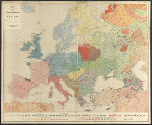
Carte ethnographique de l'Europe
23.
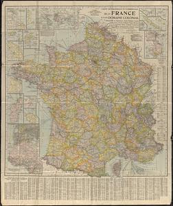
Carte geographique et commerciale de la France et de son domaine colonial : indiquant les départements, routes principales,...
24.
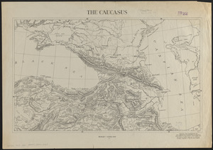
The Caucasus
25.
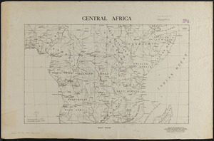
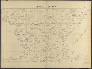
Central Africa
26.
Central Africa
27.
A chart of the gulf stream
28.
The Daily Telegraph map no. 25 : races of Eastern Europe
29.
The Daily telegraph war map no. 18
30.
The Daily Telegraph war map of Siberia (no. 28)
31.
A diagrammatic road map of Central Europe : for the use of automobilists and cyclists
32.
A draught of St. John's harbour : with the soundings
33.
Eastern Hungary
34.
Eastern Hungary
35.
Eisenbahnkarte von Österreich-Ungarn
36.
Family of Mrs. Donovan, Roxbury
37.
France
38.
France
39.
G. Freytags völker- und sprachenkarte von Österreich-Ungarn
40.
Gallup's map of Texas
‹ Prev
Next ›
1
2
3
4
5
6