Toggle navigation
LMEC Home
Exhibitions
Georeferencing
Tools for Teachers
Collections
My Favorites
Sign Up / Log In
Search
Search the map portal
Map Collection
Map Collection
Map Sets
Search
Search
Search for
Search In
All Fields
Creator
Title
Subject
Place
Search All Digital Collections
Advanced Search
79 Results
My Search
Start Over
Date
1902
Remove constraint Date: <span class='single'>1902</span>
Filter your Search
Place
North and Central America
63
United States
40
Massachusetts
17
Boston
12
Suffolk (county)
12
Canada
8
Cuba
7
Halifax Regional Municipality
6
more
Place
»
Topic
Boston (Mass.)--Maps
7
Geology--Nova Scotia--Halifax (County)--Maps
6
Gold mines and mining--Nova Scotia--Maps
6
Halifax (N.S. : County)--Maps
6
Mines and mineral resources--Nova Scotia--Halifax (County)--Maps
6
Cárdenas Bay (Cuba)--Maps
3
Massachusetts--Maps
3
New England--Maps--Early works to 1800--Facsimiles
3
more
Topic
»
Date
1902
[remove]
79
Date range begin
–
Date range end
Current results range from
1770
to
1999
1902
to
1902
79
Creator
United States. Army. Department of Cuba
7
United States. Congress (56th, 2nd session : 1900-1901). House
7
United States. Government Printing Office
7
United States. War Department
7
Geological Survey of Canada
6
National Publishing Company (Boston, Mass.)
5
Canada. Department of the Interior
3
Blanchard, Rufus, 1821-1904
2
more
Creator
»
Format
Maps/Atlases
77
Photographs
1
Prints
1
Georeferenced
Yes
11
No
68
Collection
Norman B. Leventhal Map & Education Center Collection
74
Boston and New England Maps
4
Urban Maps
4
Robert E. Diefenbach Map Collection at Phillips Academy
3
American Revolutionary War-Era Maps
1
Massachusetts Real Estate Atlases
1
Sidney R. Knafel Map Collection at Phillips Academy
1
Available to use
No known restrictions
77
Search Constraints
Sort by relevance
relevance
title
date (asc)
date (desc)
Number of results to display per page
20 per page
10
per page
20
per page
50
per page
100
per page
View results as:
grid view
map view
Search Results
21.
Ireland
22.
Lechmere Canal, Cambridge : condition of retaining walls and bed of canal, inspection for Committee on Charles River Dam, Nov....
23.
Manitoba
24.
Map of Cape Nome and adjacent mining dists
25.
A map of New England and New York
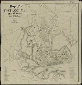
26.
Map of Portland, Me. and vicinity
27.
Map of the Back Bay Fens showing the public ways bordering and crossing them and the neighboring newly laid out parts of...
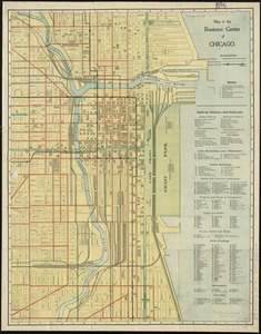
28.
Map of the business center of Chicago
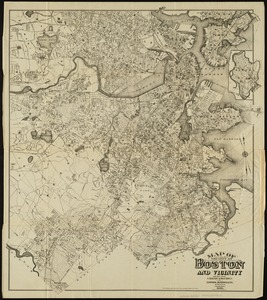
29.
Map of the city of Boston and vicinity
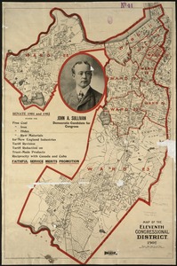
30.
Map of the Eleventh Congressional District
31.
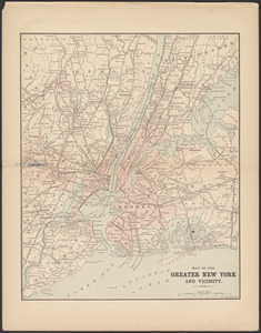
Map of the greater New York and vicinity
32.
Map of Virginia, West Virginia and Ohio : showing Norfolk and Western Railway : main line branches and connections
33.
Map showing Boston territory tributary to South Metropolitan system and Boston main drainage system
34.
Map showing Indian reservations within the limits of the United States, 1901
35.
Map showing the terminal facilities of Boston
36.
A mapp of New England
37.
Minerals
38.
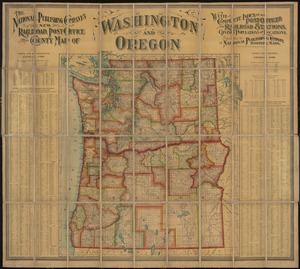
The National Publishing Company's new railroad, post-office and county map of Washington and Oregon : with complete index of...
39.
The National Publishing Company's railroad, post office, township and county map of Massachusetts, Rhode Island and Connecticut...
40.
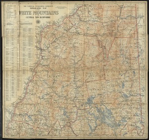
The National Publishing Company's topographic map of the White Mountains and central New Hampshire
‹ Prev
Next ›
1
2
3
4