Toggle navigation
LMEC Home
Exhibitions
Georeferencing
Tools for Teachers
Collections
My Favorites
Sign Up / Log In
Search
Search the map portal
Map Collection
Map Collection
Map Sets
Search
Search
Search for
Search In
All Fields
Creator
Title
Subject
Place
Search All Digital Collections
Advanced Search
76 Results
My Search
Start Over
1917
Remove constraint 1917
Filter your Search
Place
North and Central America
57
United States
49
Massachusetts
12
New York
8
Boston
7
Europe
7
Suffolk (county)
7
Canada
5
more
Place
»
Topic
United States--Maps
5
Boston (Mass.)--Maps
4
Fire risk assessment
3
Insurance surveys
3
World maps
3
Adirondack Mountains (N.Y.)--Maps
2
Chile--Maps
2
Cotton manufacture
2
more
Topic
»
Date
Date range begin
–
Date range end
Current results range from
1784
to
1959
View distribution
Creator
Richard Mayer (Firm)
7
C.S. Hammond & Company
5
Bromley, George Washington
4
Bromley, Walter Scott
4
Curtis, Lionel, 1872-1955
4
Illinois State Geological Survey
4
Associated Mutual Insurance Companies
3
G.W. Bromley & Co.
3
more
Creator
»
Format
Maps/Atlases
74
Photographs
2
Books
1
Georeferenced
Yes
5
No
71
Collection
Norman B. Leventhal Map & Education Center Collection
65
Boston and New England Maps
5
Urban Maps
5
American Textile History Museum Image Collection
3
Robert E. Diefenbach Map Collection at Phillips Academy
3
Massachusetts Real Estate Atlases
2
Town plans, 1830
2
American Revolutionary War-Era Maps
1
more
Collection
»
Available to use
No known restrictions
70
Search Constraints
Sort by relevance
relevance
title
date (asc)
date (desc)
Number of results to display per page
20 per page
10
per page
20
per page
50
per page
100
per page
View results as:
grid view
map view
Search Results
21.
Guatemala and Salvador from a drawing by International Railways of Central America
22.
Honduras from a drawing by International Railways of Central America
23.
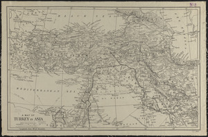
A map of Turkey in Asia
24.
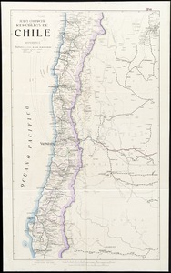
Mapa comercial de la República de Chile
25.
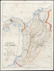
Mapa comercial de la República de Colombia
26.
The Rand-McNally new commercial atlas map of Alabama
27.
Richard Mayer's commercial map of Northern Chili, Bolivia & southern Peru
28.
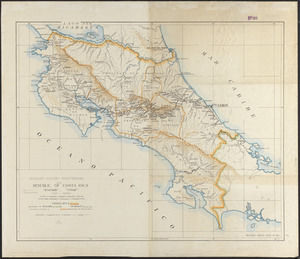
Richard Mayer's commercial of the Republic of Costa Rica
29.
Venezuela with Trinidad and part of West Indies and British Guiana
30.
Washington and vicinity
31.
Atlas of the city of Newton, Massachusetts : from actual surveys and official plans
32.
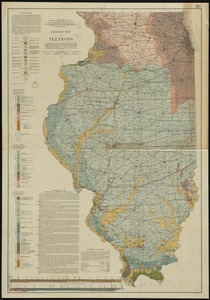
Geologic map of Illinois
33.
Hammond's complete map of New York City
34.
Hammond's new road map of eastern Massachusetts and southern New Hampshire
35.
Hammond's new road map of Rhode Island and southeastern Massachusetts
36.
Insurance maps of Gloucester, Massachusetts
37.
The lesson of the war map
38.
London
39.
Map of Cape Cod and vicinity
40.
Map of Manitoba, Saskatchewan & Alberta : showing the number of quarter sections available for homestead entry in each...
‹ Prev
Next ›
1
2
3
4