Toggle navigation
LMEC Home
Exhibitions
Georeferencing
Tools for Teachers
Collections
My Favorites
Sign Up / Log In
Search
Search the map portal
Map Collection
Map Collection
Map Sets
Search
Search
Search for
Search In
All Fields
Creator
Title
Subject
Place
Search All Digital Collections
Advanced Search
460 Results
My Search
Start Over
Date
1700
to
1749
Remove constraint Date: <span class='from'>1700</span> to <span class='to'>1749</span>
Filter your Search
Place
North and Central America
272
United States
116
Europe
69
Canada
64
North America
53
South America
48
Africa
39
France
22
more
Place
»
Topic
North America--Maps--Early works to 1800
29
Manuscript maps--Early works to 1800
24
America--Maps--Early works to 1800
19
Western Hemisphere--Maps--Early works to 1800
19
South America--Maps--Early works to 1800
16
Louisbourg (N.S.)--Maps, Manuscript--Early works to 1800
14
Louisbourg (N.S.)--History--Siege, 1745--Maps, Manuscript--Early works to 1800
13
West Indies--Maps--Early works to 1800
12
more
Topic
»
Date
1700
to
1749
[remove]
460
Date range begin
–
Date range end
Current results range from
1668
to
1800
1700
to
1704
53
1705
to
1709
50
1710
to
1714
57
1715
to
1719
50
1720
to
1724
59
1725
to
1729
44
1730
to
1734
75
1735
to
1739
90
1740
to
1744
77
1745
to
1749
125
Creator
Moll, Herman, d. 1732
60
George, III, King of Great Britain, 1738-1820
40
George, IV, King of Great Britain, 1762-1830
39
L'Isle, Guillaume de, 1675-1726
25
Bellin, Jacques Nicolas, 1703-1772
17
Royal United Services Institute for Defence and Security Studies
17
Bastide, John Henry, approximately 1700-1770
15
Bowles, John, 1701-1779
14
more
Creator
»
Format
Maps/Atlases
451
Manuscripts
70
Drawings/Illustrations
5
Prints
3
Georeferenced
Yes
25
No
435
Collection
Norman B. Leventhal Map & Education Center Collection
300
American Revolutionary War-Era Maps
129
British Library Collection
73
Maritime Charts and Atlases
46
Boston and New England Maps
33
William L. Clements Library Collection
28
Newberry Library Collection
22
Urban Maps
17
more
Collection
»
Available to use
No known restrictions
296
Creative Commons license
102
Search Constraints
Sort by relevance
relevance
title
date (asc)
date (desc)
Number of results to display per page
20 per page
10
per page
20
per page
50
per page
100
per page
View results as:
grid view
map view
Search Results
241.
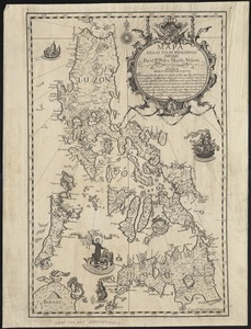
Mapa de las yslas Philipinas
242.
A Mappe of Colonel Römers Voyage to ye: 5 Indian nations going from New Yorck to Albany thence west to ye 3 Macquas Castle and...
243.
Mappe-monde
244.
Mappmonde ou description generale du globe terrestre
245.
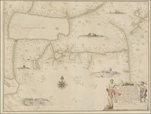
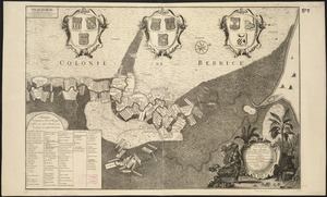
Naaukeurige platte grond van den staat loop van Rio de Berbice met derzelver plantagien in de geoctrojeerde colonie de Berbice
246.
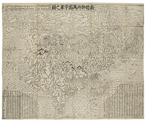
Nansenbushu bankoku shoka no zu
247.
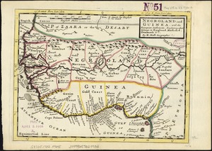
Negroland and Guinea : with the European settlements explaining what belongs to England, Holland, Denmark &c
248.
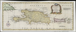
A new & accurate map of the islands of Hispaniola or St. Domingo, and Porto Rico
249.
A new & correct map of the whole world : shewing ye situation of its principal parts. viz. the oceans, kingdoms, rivers, capes,...
250.
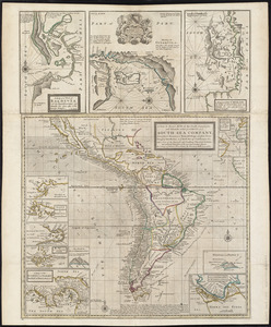
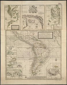
A new & exact map of the coast, countries and islands within ye limits of ye South Sea Company, from ye river Aranoca to Terra...
251.
A new & exact map of the coast, countries and islands within ye limits of ye South Sea Company, from ye river Aranoca to Terra...
252.
A new & exact map of the electorate of Brunswick-Lunenburg and ye rest of ye Kings dominions in Germany : very much improved by...
253.
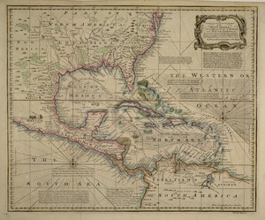
A new and accurate chart of the West Indies : with the adjacent coasts of North and South America
254.
A new and accurate map of New Jersey, Pensilvania, New York and New England : with the adjacent countries. Drawn from surveys,...
255.
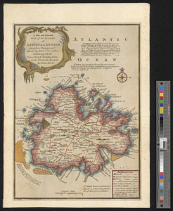
A new and accurate map of the island of Antigua or Antego, taken from surveys and adjusted by astronl. observations, containing...
256.
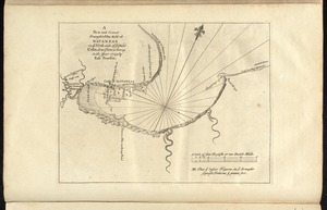
A new and correct draught of the bay of Matanzas : on ye north side of ye island of Cuba ; done from a survey in the year 1729...
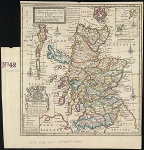
257.
A new and correct map of Scotland and the Isles : containing all ye cities, market towns, boroughs &c., the principal roads,...
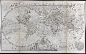
258.
A new and correct map of the world : laid down according to the newest discoveries and from the most exact observations
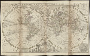
259.
A new and correct map of the world, laid down according to the newest discoveries, and from the most exact observations
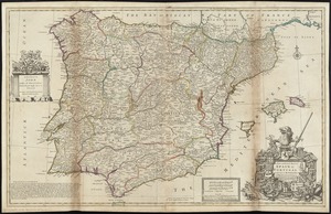
260.
A new and exact map of Spain & Portugal divided into its kingdoms and principalities &c with ye principal roads and...
‹ Prev
Next ›
1
2
…
9
10
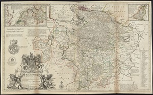
11
12
13
14
15
16
17
…
22
23