Toggle navigation
LMEC Home
Exhibitions
Georeferencing
Tools for Teachers
Collections
My Favorites
Sign Up / Log In
Search
Search the map portal
Map Collection
Map Collection
Map Sets
Search
Search
Search for
Search In
All Fields
Creator
Title
Subject
Place
Search All Digital Collections
Advanced Search
26 Results
My Search
Start Over
Date
1702
Remove constraint Date: <span class='single'>1702</span>
Filter your Search
Place
North and Central America
12
Europe
7
United States
7
New York
5
North America
4
Spain
4
Africa
3
Cape Verde
3
more
Place
»
Topic
Africa, West--Maps--Early works to 1800
3
Cape Verde--Maps--Early works to 1800
3
North America--Maps--Early works to 1800
3
Azores--Maps--Early works to 1800
2
Canary Islands--Maps--Early works to 1800
2
America--Maps--Early works to 1800
1
Atlantic Ocean--Maps
1
Atlantic States--Maps--Early works to 1800
1
more
Topic
»
Date
1702
[remove]
26
Date range begin
–
Date range end
Current results range from
1668
to
1800
1702
to
1702
26
Creator
Burghers, M.
2
Fer, Nicolas de, 1646-1720
2
Nolin, Jean Baptiste, 1686-1762
2
Hayashi, Yoshinaga
1
Homann, Johann Baptist, 1663-1724
1
Keulen, Johannes van, 1654-1715
1
Mather, Cotton, 1663-1728
1
Nolin, Jean Baptiste, 1648-1708
1
more
Creator
»
Format
Maps/Atlases
26
Manuscripts
2
Georeferenced
Yes
1
No
25
Collection
Norman B. Leventhal Map & Education Center Collection
17
American Revolutionary War-Era Maps
8
William L. Clements Library Collection
7
Library of Congress Collection
1
MacLean Collection Map Library
1
Mapping Boston Collection
1
Maritime Charts and Atlases
1
Urban Maps
1
Available to use
No known restrictions
16
Creative Commons license
2
Search Constraints
Sort by relevance
relevance
title
date (asc)
date (desc)
Number of results to display per page
20 per page
10
per page
20
per page
50
per page
100
per page
View results as:
grid view
map view
Search Results
1.
[Amerique septentrionale]
2.
L'Amérique Septentrionale & Meridionale divisée en ses principales parties, ou sont distingués les vns des autres les estats...
3.
Archipelagus Atlanticus cum suis insulis Canariis, Hesperidibus et Azoribus
4.
Le Canada, ou Nouvelle France, la Floride, la Virginie, Pensilvanie, Caroline, Nouvelle Angleterre et Nouvelle Yorck, l'Isle de...
5.
Carte de la Russie en Europe : pour servir al'Introduction a l'histoire universelle du Baron de Pufendorf
6.
Carte du diocèse d'Uzès
7.
Cuba, ciudad capittal de la ysla del mismo nombre y su famoso puerto sittuado en la costa del sur de gra. ysla, los 20 grados y...
8.
Le Diocese de Limoges : divisé en ses dix huict Archipretré et les Gouvernemens de la Marche et du Limosin dans les quels il...
9.
An exact mapp of New England and New York
10.
Generalis Lotharingiae Ducatus Tabula, qua accuratissime oftenduntur Ducatus Lotharingiae Propriae et Barrensis nec non...
11.
The Gulf coast from the Mississippi Delta to the Bay of St. Joseph
12.
Isles de Cap Verd coste, et pays des Negres
13.
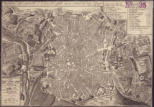
Madrid, ville considérable de la nouvelle Castille, séjour ordinaire des Roys d'Espagne
14.
A map of lot no 1 in the Hardenbergh Patent
15.
A map of lot no 4 in the [Ha]rdenbergh Patent
16.
A map of part of the Isthmus of Darien : shewing the communication with Panama, from Portobello & Chagre both by land, and by...
17.
A new map of North America shewing its principal divisions, chief cities, townes, rivers, mountains &c
18.
A new map of the terraqueous globe according to the latest discoveries and most general divisions of it into continents and oceans
19.
Part of modern Orange County
20.
Paskaart van de cust van Portugal, Barbaria en Genehoa : beginnende van d'Barlenges tot aan C. Verde met al zyn Diepte en...
‹ Prev
Next ›
1
2
![[Amerique septentrionale]](https://bpldcassets.blob.core.windows.net/derivatives/images/commonwealth:8336h2955/image_thumbnail_300.jpg)


![A map of lot no 4 in the [Ha]rdenbergh Patent](https://bpldcassets.blob.core.windows.net/derivatives/metadata/commonwealth-oai:zs262628v/image_thumbnail_300.jpg)


