Toggle navigation
LMEC Home
Exhibitions
Georeferencing
Tools for Teachers
Collections
My Favorites
Sign Up / Log In
Search
Search the map portal
Map Collection
Map Collection
Map Sets
Search
Search
Search for
Search In
All Fields
Creator
Title
Subject
Place
Search All Digital Collections
Advanced Search
29 Results
My Search
Start Over
1931
Remove constraint 1931
Filter your Search
Place
United States
21
North and Central America
20
Cheshire (county)
3
Keene
3
Boston
2
Suffolk (county)
2
Worcester (county)
2
Africa
1
more
Place
»
Topic
Fire risk assessment
7
Insurance surveys
7
Keene (N.H.)--Maps
3
Textile factories
3
Blankets
2
United States--Maps
2
Warehouses
2
Africa--Maps
1
more
Topic
»
Date
Date range begin
–
Date range end
Current results range from
1830
to
1986
View distribution
Creator
Associated Factory Mutual Fire Insurance Companies
5
Wadsworth, Samuel, 1846-1931
3
Houghton Mifflin Company
2
A. Hoen & Co.
1
Aitchison, R. T. (Robert T.), 1887-1964
1
Anderson, Philander, 1810?-1853
1
Associated Mutual Insurance Companies
1
Barrère, Henry
1
more
Creator
»
Format
Maps/Atlases
29
Georeferenced
Yes
2
No
27
Collection
Norman B. Leventhal Map Center Collection
21
American Textile History Museum Image Collection
7
Boston and New England Maps
3
Urban Maps
3
Town plans, 1830
1
Available to use
No known restrictions
22
Search Constraints
Sort by title
relevance
title
date (asc)
date (desc)
Number of results to display per page
20 per page
10
per page
20
per page
50
per page
100
per page
View results as:
grid view
map view
Search Results
1.
Afrique 1899
2.
Atlas of the city of Boston : Roxbury : from actual surveys and official plans
3.
Being a map of the United States in the year 1831 when the Country Gentleman first made its appearance as the Genesee Farmer
4.
Bus routes Boston Elevated Railway 1931 July 18
5.
A chart of the history of printing in Europe
6.
Chatham Mfg. Co., Mill No. 2, Winston-Salem, N.C. [insurance map]
7.
Farnsworth Company, Lisbon, Me., Tenements, P.O. Lisbon Centre, Me. [insurance map]
8.
General Electric Supply Corporation (Ten.), Commercial Street Trust Co. (Bldg.) (Sales & Storage), New Bedford, Mass....
9.
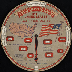
Geographic chart of the United States and our presidents
10.
H. W. Clark (Bldg.), H. W. Clark Company (Ten.) (Storage), North Adams, Mass. [insurance map]
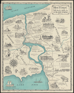
11.
Historic Niagara Frontier
12.
An historical and literary map of the Old Line State of Maryland : showing forth divers curious and notable facts relating to...
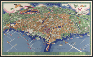
13.
An illustrated map of Chicago : youthful city of the big shoulders, restless, ingenious, wilful, violent, proud to be alive!
14.
Independent Lock Company (Metal Working), Fitchburg, Mass. [insurance map]
15.
International Paper Co. (Electric Power Plant), Jay, Me. [insurance map]
16.
Map of Keene including the original boundaries of upper Ashuelot
17.
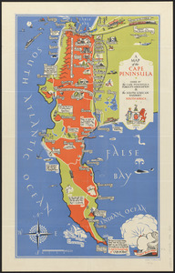
A map of the Cape Peninsula
18.
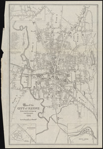
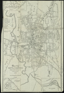
Map of the city of Keene, from recent surveys
19.
Map of the city of Keene, from recent surveys
20.
A map of the Seneca villages and the Jesuit and French contacts 1615-1708
‹ Prev
Next ›
1
2


![Chatham Mfg. Co., Mill No. 2, Winston-Salem, N.C. [insurance map]](https://bpldcassets.blob.core.windows.net/derivatives/images/commonwealth:2r36vc786/image_thumbnail_300.jpg)
![Farnsworth Company, Lisbon, Me., Tenements, P.O. Lisbon Centre, Me. [insurance map]](https://bpldcassets.blob.core.windows.net/derivatives/images/commonwealth:4j03df31d/image_thumbnail_300.jpg)
![General Electric Supply Corporation (Ten.), Commercial Street Trust Co. (Bldg.) (Sales & Storage), New Bedford, Mass. [insurance map]](https://bpldcassets.blob.core.windows.net/derivatives/images/commonwealth:ww72bz405/image_thumbnail_300.jpg)
![H. W. Clark (Bldg.), H. W. Clark Company (Ten.) (Storage), North Adams, Mass. [insurance map]](https://bpldcassets.blob.core.windows.net/derivatives/images/commonwealth:9880vw94n/image_thumbnail_300.jpg)

![Independent Lock Company (Metal Working), Fitchburg, Mass. [insurance map]](https://bpldcassets.blob.core.windows.net/derivatives/images/commonwealth:ww72bx80x/image_thumbnail_300.jpg)
![International Paper Co. (Electric Power Plant), Jay, Me. [insurance map]](https://bpldcassets.blob.core.windows.net/derivatives/images/commonwealth:4j03df17k/image_thumbnail_300.jpg)