Toggle navigation
LMEC Home
Exhibitions
Georeferencing
Tools for Teachers
Collections
My Favorites
Sign Up / Log In
Search
Search the map portal
Map Collection
Map Collection
Map Sets
Search
Search
Search for
Search In
All Fields
Creator
Title
Subject
Place
Search All Digital Collections
Advanced Search
1023 Results
My Search
Start Over
More Like
commonwealth-oai:rv046r823
Remove constraint More Like: commonwealth-oai:rv046r823
Filter your Search
Place
North and Central America
993
United States
717
New York
255
Canada
219
Quebec
119
Pennsylvania
69
New Jersey
62
Nova Scotia
49
more
Place
»
Topic
United States--History--Revolution, 1775-1783--Maps
305
United States--History--French and Indian War, 1754-1763--Maps
162
New York (State)--Maps
85
Saint Lawrence River--Maps
44
Vermont--Maps
29
New England--Maps
28
Newport (R.I.)--Maps
27
Pennsylvania--Maps
27
more
Topic
»
Date
Date range begin
–
Date range end
Current results range from
1700
to
1976
View distribution
Creator
Rocque, Mary Ann
29
Jefferys, Thomas, -1771
28
Holland, Samuel, 1728-1801
27
Montrésor, John, 1736-1799
26
Bellin, Jacques Nicolas, 1703-1772
25
Clinton, Henry, Sir, 1738?-1795
19
Robert Sayer and John Bennett (Firm)
16
Orme, Robert, -1781
14
more
Creator
»
Format
Maps/Atlases
1,007
Drawings/Illustrations
11
Documents
5
Manuscripts
2
Prints
1
Georeferenced
Yes
11
No
1,012
Collection
American Revolutionary War-Era Maps
949
William L. Clements Library Collection
909
Norman B. Leventhal Map & Education Center Collection
79
Boston and New England Maps
26
American Antiquarian Society Collection
17
MacLean Collection Map Library
6
Library and Archives Canada Collection
4
Richard H. Brown Revolutionary War Map Collection at Mount Vernon
4
more
Collection
»
Available to use
No known restrictions
81
Creative Commons license
5
Search Constraints
Sort by relevance
relevance
title
date (asc)
date (desc)
Number of results to display per page
20 per page
10
per page
20
per page
50
per page
100
per page
View results as:
grid view
map view
Search Results
381.
City of St. Augustine and environs
382.
The coast from St. Johns, New Brunswick, to Goldsborough Bay, Maine
383.
The coast of Maine from modern Portland to Desert Island
384.
Coast of Senegal
385.
Ye commencement for draft of New York Island
386.
The communication between the Iberville and the river Mississippe
387.
A compleat plan of part of the province of Pennsylvania East and West Jersey shewing the transactions of the royal army under...
388.
Confluence of the James River, York River, and Chesapeake Bay
389.
Copie de la carte de Monsieur Klam ou l'on voit les sources e la riviere d'Orange suivant de nouvelles observation
390.
Copy of a plan of the river Iberville from Lake Maurepas to the forks, with part of the Comit and Amit : taken from engineer...
391.
Copy of a plan of York harbour with the soundings, shoals &c. surveyed by order of Lt Governor Simcoe
392.
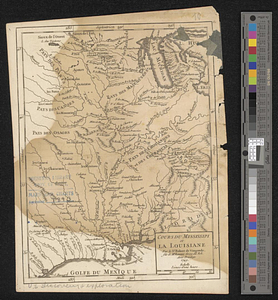
Cours du Mississipi et la Louisiane
393.
Dartmouth
394.
The Delancey lands on Manhattan Island
395.
Delaware Bay and Chesapeake Bay
396.
Delaware Bay and Chesapeake Bay
397.
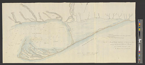
Discription [sic] of the roads about White Plains
398.
Disposition of the British forces before Charleston 1780
399.
Disposition of the British forces on Long Island, Staten Island, and Manhattan Island, under Cornwallis and Knyphausen
400.
Distances North River
‹ Prev
Next ›
1
2
…
16
17
18
19
20
21
22
23
24
…
51
52


![Discription [sic] of the roads about White Plains](https://bpldcassets.blob.core.windows.net/derivatives/metadata/commonwealth-oai:w3767301r/image_thumbnail_300.jpg)


