Toggle navigation
LMEC Home
Exhibitions
Georeferencing
Tools for Teachers
Collections
My Favorites
Sign Up / Log In
Search
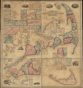
Search the map portal
Map Collection
Map Collection
Map Sets
Search
Search
Search for
Search In
All Fields
Creator
Title
Subject
Place
Search All Digital Collections
Advanced Search
1121 Results
My Search
Start Over
More Like
commonwealth-oai:d504wj82k
Remove constraint More Like: commonwealth-oai:d504wj82k
Filter your Search
Place
North and Central America
1,095
United States
819
Massachusetts
250
Canada
205
New York
195
Quebec
111
Suffolk (county)
67
Rhode Island
63
more
Place
»
Topic
United States--History--Revolution, 1775-1783--Maps
306
Massachusetts--Maps
218
United States--History--French and Indian War, 1754-1763--Maps
149
Boston (Mass.)--Maps
55
Saint Lawrence River--Maps
43
Rhode Island--Maps
32
Railroads--Massachusetts--Maps
31
Newport (R.I.)--Maps
27
more
Topic
»
Date
Date range begin
–
Date range end
Current results range from
1700
to
2020
View distribution
Creator
Rocque, Mary Ann
29
Holland, Samuel, 1728-1801
25
Montrésor, John, 1736-1799
25
Bellin, Jacques Nicolas, 1703-1772
24
Jefferys, Thomas, -1771
24
Clinton, Henry, Sir, 1738?-1795
19
Geo. H. Walker & Co
15
Robert Sayer and John Bennett (Firm)
15
more
Creator
»
Format
Maps/Atlases
1,103
Drawings/Illustrations
11
Documents
5
Manuscripts
3
Prints
2
Ephemera
1
Georeferenced
Yes
65
No
1,056
Collection
American Revolutionary War-Era Maps
920
William L. Clements Library Collection
909
Norman B. Leventhal Map & Education Center Collection
190
Boston and New England Maps
155
David Judkins Weaver Papers
17
Urban Maps
11
Sidney R. Knafel Map Collection at Phillips Academy
8
Applied Geographics, Inc. Records
6
more
Collection
»
Available to use
No known restrictions
182
Creative Commons license
12
Search Constraints
Sort by relevance
relevance
title
date (asc)
date (desc)
Number of results to display per page
20 per page
10
per page
20
per page
50
per page
100
per page
View results as:
grid view
map view
Search Results
1.
Flynt Jenkins sold to Taylor Foster &c plans 1778
2.
Surveyed by Daniel Newhall for Capt Caleb Leland and sold to James Wilder, February 1800
3.
This sheet contains plans of mr Nehemiah Wymans farm the two plans are to be joined into one where they are marked thus : they...
4.
Massachusetts open space and recreation facilities
5.
A map of 100 miles round Boston
6.
A map of the colony of Rhode Island : with the adjacent parts of Connecticut, Massachusetts Bay, &c.
7.
Plan of the roads between Boston and Albany : survey'd by order of the governor in pursuance of a resolution of the General...
8.
Upper New York, Vermont, and Massachusetts
9.
Map of the counties of Barnstable, Dukes and Nantucket, Massachusetts : based upon the trigonometrical survey of the state
10.
The 100th anniversary map of Abraham Lincoln's visit to Massachusetts, September 11-23, 1848
11.
An accurate map of the commonwealth of Massachusetts exclusive of the district of Maine compiled pursuant to an act of the...
12.
Annexation map
13.
Atlas of Massachusetts
14.
Atlas of Massachusetts
15.
Automobile map of Massachusetts : central section
16.
Bicycle map of Massachusetts
17.
Bicycle map of north eastern Massachusetts
18.
Bicycle map of south eastern Massachusetts
19.
Bicycle map of western Massachusetts
20.
Boston & Gloucester Steamboat Co. : summer season 1889
‹ Prev
Next ›
1
2
3
4
5
…
56
57