Toggle navigation
LMEC Home
Exhibitions
Georeferencing
Tools for Teachers
Collections
My Favorites
Sign Up / Log In
Search
Search the map portal
Map Collection
Map Collection
Map Sets
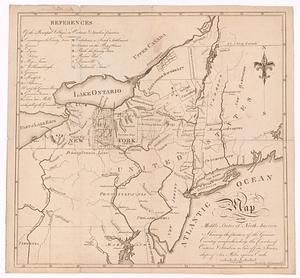
Search
Search
Search for
Search In
All Fields
Creator
Title
Subject
Place
Search All Digital Collections
Advanced Search
995 Results
My Search
Start Over
More Like
commonwealth-oai:7d27dp968
Remove constraint More Like: commonwealth-oai:7d27dp968
Filter your Search
Place
North and Central America
969
United States
699
New York
251
Canada
208
Quebec
112
Pennsylvania
69
New Jersey
62
Nova Scotia
48
more
Place
»
Topic
United States--History--Revolution, 1775-1783--Maps
305
United States--History--French and Indian War, 1754-1763--Maps
150
New York (State)--Maps
85
Saint Lawrence River--Maps
43
Vermont--Maps
29
New England--Maps
27
Newport (R.I.)--Maps
27
Pennsylvania--Maps
27
more
Topic
»
Date
Date range begin
–
Date range end
Current results range from
1700
to
1976
View distribution
Creator
Rocque, Mary Ann
29
Holland, Samuel, 1728-1801
26
Bellin, Jacques Nicolas, 1703-1772
25
Montrésor, John, 1736-1799
25
Jefferys, Thomas, -1771
24
Clinton, Henry, Sir, 1738?-1795
19
Robert Sayer and John Bennett (Firm)
15
Hills, John, active 1777-1819
13
more
Creator
»
Format
Maps/Atlases
979
Drawings/Illustrations
11
Documents
5
Manuscripts
2
Prints
1
Georeferenced
Yes
11
No
984
Collection
American Revolutionary War-Era Maps
932
William L. Clements Library Collection
909
Norman B. Leventhal Map & Education Center Collection
64
Boston and New England Maps
25
American Antiquarian Society Collection
15
MacLean Collection Map Library
4
Massachusetts Historical Society Map Collection
1
New-York Historical Society Collection
1
more
Collection
»
Available to use
No known restrictions
65
Creative Commons license
1
Search Constraints
Sort by relevance
relevance
title
date (asc)
date (desc)
Number of results to display per page
20 per page
10
per page
20
per page
50
per page
100
per page
View results as:
grid view
map view
Search Results
1.
French draught of Lake Champlain & Lake George with remarks of an English prisoner who return'd from Quebec to Fort Edward by...
2.
A map of New York showing counties, manors, townships, and estates, ca. 1778
3.
Four wood lots in no 3
4.
The Johnans. Turner farm
5.
M. Progues wood land
6.
A map of a piece of land surveyd for Peter Coem in lot no 3 belonging the Henry Livingston esqr & laid down from a scale of 10...
7.
A map of lot no 1 in the Hardenbergh Patent
8.
Subdivision of lot no. 12 in the Good Beer Kill tract : performed this 4th day of Octr. 1797
9.
Survey bill of Peter Hams farm, (as he now has the same in fence) situate in great lot no. 2 in the manor of Livingston :...
10.
A chorographical map of the northern department of North-America : drawn from the latest and most accurate observations
11.
Upper New York, Vermont, and Massachusetts
12.
Map of Morris's Purchase or West Geneseo in the state of New York : exhibiting part of the Lakes Erie and Ontario, the...
13.
A map of the middle states of North America, shewing the position of the Geneseo country comprehending the counties of Ontario...
14.
The state of New York with part of the adjacent states
15.
15 lots of 440a each in Great Lot no. 4 of Macomb purchase : 6600 acres within 2 miles of the St. Lawrence Turnpike & 1/2 mile...
16.
An accurate map of New York in North America from a late survey
17.
Fragment of map showing two small fortifications
18.
A new and accurate map of the present seat of war in North America
19.
Part of the counties of Charlotte and Albany, in the province of New York; being the seat of war between the king's forces...
20.
Part of the modern counties of Union, Somerset, Hunterdon, Morris, Essex, Bergen, Passaic, Sussex, and Warren in New Jersey and...
‹ Prev
Next ›
1
2
3
4
5
…
49
50