Toggle navigation
LMEC Home
Exhibitions
Georeferencing
Tools for Teachers
Collections
My Favorites
Sign Up / Log In
Search
Search the map portal
Map Collection
Map Collection
Map Sets
Search
Search
Search for
Search In
All Fields
Creator
Title
Subject
Place
Search All Digital Collections
Advanced Search
929 Results
My Search
Start Over
More Like
commonwealth-oai:66832283c
Remove constraint More Like: commonwealth-oai:66832283c
Filter your Search
Place
North and Central America
903
United States
643
Canada
205
New York
192
Quebec
111
Pennsylvania
60
New Jersey
54
Nova Scotia
48
more
Place
»
Topic
United States--History--Revolution, 1775-1783--Maps
305
United States--History--French and Indian War, 1754-1763--Maps
149
Saint Lawrence River--Maps
43
Newport (R.I.)--Maps
27
New York (State)--Maps
24
Georgia--Maps
23
Hudson River (N.Y. and N.J.)--Maps
21
Québec (Québec)--Maps
21
more
Topic
»
Date
Date range begin
–
Date range end
Current results range from
1700
to
1987
View distribution
Creator
Rocque, Mary Ann
29
Bellin, Jacques Nicolas, 1703-1772
26
Holland, Samuel, 1728-1801
25
Montrésor, John, 1736-1799
25
Jefferys, Thomas, -1771
24
Clinton, Henry, Sir, 1738?-1795
19
Robert Sayer and John Bennett (Firm)
15
Hills, John, active 1777-1819
13
more
Creator
»
Format
Maps/Atlases
913
Drawings/Illustrations
11
Documents
5
Prints
1
Georeferenced
Yes
3
No
926
Collection
American Revolutionary War-Era Maps
915
William L. Clements Library Collection
909
Norman B. Leventhal Map & Education Center Collection
14
Maps from AAS
6
Applied Geographics, Inc. Records
1
Available to use
No known restrictions
14
Search Constraints
Sort by relevance
relevance
title
date (asc)
date (desc)
Number of results to display per page
20 per page
10
per page
20
per page
50
per page
100
per page
View results as:
grid view
map view
Search Results
1.
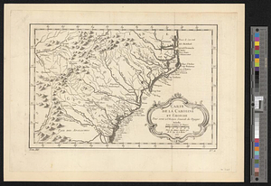
Carte de la Caroline at Georgie pour servir à l'histoire générale des voyages : tirée des auteurs Anglois
2.
A map of the sea coast of Georgia & the inland parts thereof extending to the westward of that part of Savannah called Broad...
3.
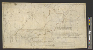
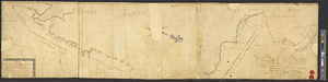
To Lachlan Mc: Gillivray esqr: deputy superintendant : this sketch of the boundary line between the province of Georgia and the...
4.
Carte de la Caroline et Georgie. : Pour servir à l'Histoire générale des voyages
5.
Carte de la Caroline et Georgie. : Pour servir à l'Histoire générale des voyages
6.
Georgia, from the latest authorities
7.
Georgia from the latest authorities
8.
Map of northern Georgia
9.
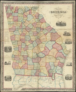
Map of the state of Georgia
10.
Middle Georgia & South Carolina
11.
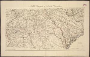
[Middle Georgia and South Carolina]
12.
Mississippi Territory and Georgia
13.
A new & accurate map of the provinces of North & South Carolina Georgia &c
14.
A New and accurate map of the chief parts of South Carolina, and Georgia
15.
A New map of the Cherokee nation : with the names of the towns & rivers they are situated on No. lat from 34 to 36
16.
Northern Alabama and Georgia
17.
Northern Georgia with portions of adjacent states
18.
Northwestern Georgia : (with portions of the adjoining states of Tennessee and Alabama) being part of the Department of the...
19.
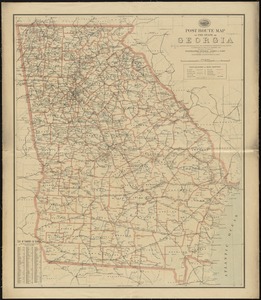
Post route map of the State of Georgia showing post offices with the intermediate distances and mail routes in operation on the...
20.
Post route map of the state of Georgia showing post offices with the intermediate distances on mail routes in operation on the...
‹ Prev
Next ›
1
2
3
4
5
…
46
47


![[Middle Georgia and South Carolina]](https://bpldcassets.blob.core.windows.net/derivatives/images/commonwealth:7h14b2665/image_thumbnail_300.jpg)