Toggle navigation
LMEC Home
Exhibitions
Georeferencing
Tools for Teachers
Collections
My Favorites
Sign Up / Log In
Search
Search the map portal
Map Collection
Map Collection
Map Sets
Search
Search
Search for
Search In
All Fields
Creator
Title
Subject
Place
Search All Digital Collections
Advanced Search
1014 Results
My Search
Start Over
More Like
commonwealth-oai:3r078t62x
Remove constraint More Like: commonwealth-oai:3r078t62x
Filter your Search
Place
North and Central America
988
United States
726
Canada
206
New York
201
Quebec
112
Pennsylvania
90
New Jersey
79
Virginia
73
more
Place
»
Topic
United States--History--Revolution, 1775-1783--Maps
308
United States--History--French and Indian War, 1754-1763--Maps
149
Pennsylvania--Maps
50
Virginia--Maps
47
Saint Lawrence River--Maps
43
New Jersey--Maps
40
Maryland--Maps
37
New York (State)--Maps
34
more
Topic
»
Date
Date range begin
–
Date range end
Current results range from
1700
to
1988
View distribution
Creator
Rocque, Mary Ann
29
Bellin, Jacques Nicolas, 1703-1772
26
Holland, Samuel, 1728-1801
26
Montrésor, John, 1736-1799
25
Jefferys, Thomas, -1771
24
Clinton, Henry, Sir, 1738?-1795
19
Robert Sayer and John Bennett (Firm)
15
Hills, John, active 1777-1819
13
more
Creator
»
Format
Maps/Atlases
998
Drawings/Illustrations
11
Documents
5
Manuscripts
2
Prints
1
Georeferenced
Yes
39
No
975
Collection
American Revolutionary War-Era Maps
934
William L. Clements Library Collection
909
Norman B. Leventhal Map & Education Center Collection
86
Maps from AAS
13
MacLean Collection Map Library
5
Urban Maps
2
David Judkins Weaver Papers
1
New York Public Library Collection
1
Available to use
No known restrictions
86
Creative Commons license
1
Search Constraints
Sort by relevance
relevance
title
date (asc)
date (desc)
Number of results to display per page
20 per page
10
per page
20
per page
50
per page
100
per page
View results as:
grid view
map view
Search Results
961.
Survey on Red River
962.
Surveyed by Daniel Newhall for Capt Caleb Leland and sold to James Wilder, February 1800
963.
Surveyed for George Rogers Clark 36.962 acres of land...lying in Lincoln County and on the Ohio : June 7th, 1784
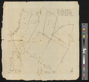
964.
These plans represent the land of Capt Ebenezer Brook, late of Medford
965.
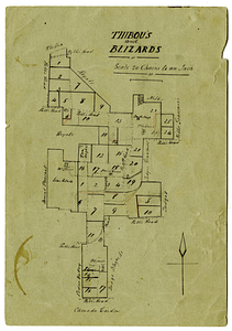
Thibou's and Blizards
966.
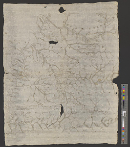
Thirty-miles round Boston
967.
This map of Kentucke, drawn from actual observations ...
968.
This sheet contains plans of mr Nehemiah Wymans farm the two plans are to be joined into one where they are marked thus : they...
969.
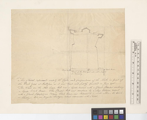
This sketch represents nearly the figure and proportions of the work in front of the dock yard at Hallifax as it was traced and...
970.
Tilforladelig kort over eylandet St. Croix udi America : saaledes som det ved en acurat udmaaling er befunden met quarterernes...
971.
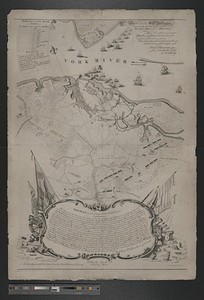
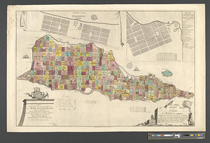
To his e[xcellency] G. Washington commander in chief of the armies of the United States of America this plan of the investment...
972.
To his excellency General Washington, commander in chief of the armies of the United States of America : this plan of the...
973.
To Lachlan Mc: Gillivray esqr: deputy superintendant : this sketch of the boundary line between the province of Georgia and the...
974.
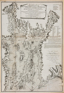
A topographical chart of the bay of Narraganset in the province of New England, with all the isles contained therein, among...
975.
Topographical map of the province of New Hampshire, including Montresor's survey of the St. Lawrence and the Kennebec route to...
976.
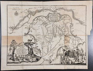
A topographical plan of that part of the Indian-country through which the army under the command of Colonel Bouquet marched in...
977.
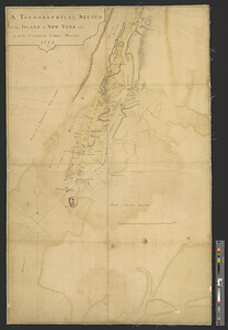
A topographical sketch of the island of New York, with part of the circumjacent country : November 1775
978.
Topographick plan by the eye, 1754 & 6
979.
The town & harbour of Boston &c.
980.
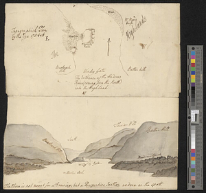
Town of Three Rivers
‹ Prev
Next ›
1
2
…
45
46
47
48
49
50
51


![To his e[xcellency] G. Washington commander in chief of the armies of the United States of America this plan of the investment of York and Goucester [sic] has been surveyed and laid down, and is most humbly dedicated](https://bpldcassets.blob.core.windows.net/derivatives/metadata/commonwealth-oai:9g552g940/image_thumbnail_300.jpg)