Toggle navigation
LMEC Home
Exhibitions
Georeferencing
Tools for Teachers
Collections
My Favorites
Sign Up / Log In
Search
Search the map portal
Map Collection
Map Collection
Map Sets
Search
Search
Search for
Search In
All Fields
Creator
Title
Subject
Place
Search All Digital Collections
Advanced Search
995 Results
My Search
Start Over
More Like
commonwealth-oai:0g358d519
Remove constraint More Like: commonwealth-oai:0g358d519
Filter your Search
Place
North and Central America
944
United States
638
Canada
209
New York
192
Quebec
111
North America
96
Pennsylvania
60
New Jersey
54
more
Place
»
Topic
United States--History--Revolution, 1775-1783--Maps
306
United States--History--French and Indian War, 1754-1763--Maps
149
North America--Maps
85
Saint Lawrence River--Maps
46
Newport (R.I.)--Maps
27
New York (State)--Maps
24
United States--Maps
23
Hudson River (N.Y. and N.J.)--Maps
21
more
Topic
»
Date
Date range begin
–
Date range end
Current results range from
1700
to
1945
View distribution
Creator
Rocque, Mary Ann
29
Bellin, Jacques Nicolas, 1703-1772
25
Holland, Samuel, 1728-1801
25
Jefferys, Thomas, -1771
25
Montrésor, John, 1736-1799
25
Clinton, Henry, Sir, 1738?-1795
19
Robert Sayer and John Bennett (Firm)
16
Kitchin, Thomas, 1719-1784
14
more
Creator
»
Format
Maps/Atlases
979
Drawings/Illustrations
11
Documents
5
Prints
1
Georeferenced
Yes
14
No
981
Collection
American Revolutionary War-Era Maps
942
William L. Clements Library Collection
909
Norman B. Leventhal Map & Education Center Collection
53
American Antiquarian Society Collection
17
New York Public Library Collection
9
MacLean Collection Map Library
6
Richard H. Brown Revolutionary War Map Collection at Mount Vernon
1
Available to use
No known restrictions
53
Creative Commons license
11
Search Constraints
Sort by relevance
relevance
title
date (asc)
date (desc)
Number of results to display per page
20 per page
10
per page
20
per page
50
per page
100
per page
View results as:
grid view
map view
Search Results
1.
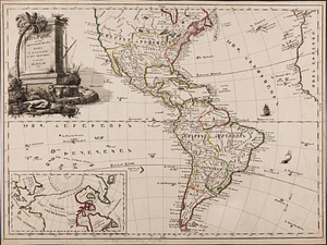
America, engraved according to recent geographical observations
2.
L'Amérique, divisée par grands etats
3.
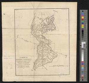
Carte du nouveau continent selon sa plus grande longueur diamètrale depuie la riv'. de la Plata jusqu'au delà du lac des...
4.
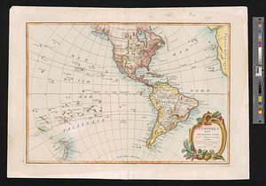
The Western Hemisphere from the latest discoveries
5.
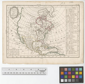
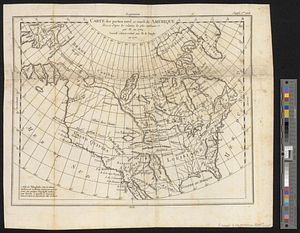
L'Amérique Septentrionale
6.
Amérique Septentrionale divisée en ses principaux etats
7.
The British colonies in North America
8.
Carte des parties nord et ouest de l'Amérique dressée d'apres les relations les plus authentique par M... en 1764 : nouvelle...
9.
A general map of North America drawn from the best surveys 1795
10.
A new and accurate map of North America laid down according to the latest and most approved observations, and discoveries
11.
North America
12.
North America
13.
North America with the West India islands
14.
Nova orbis sive America Septentrionalis per sua regna provinc. et insul. cura et opera
15.
The United States according to the definitive treaty of peace signed at Paris, Septr. 3d. 1783 ...
16.
America
17.
America
18.
America : Nach Arrowsmith, Brué und Lapie mit Benutzung der neuesten Vermessungen
19.
America : nach Arrowsmith, Brué und Lapie mit Benutzung der neuesten-Vermessungen
20.
America, with the European Settlements, and the conquests of Cortes and Pizarro
‹ Prev
Next ›
1
2
3
4
5
…
49
50